WCF SECTION PRESS RELEASE #20-57

SECTION NET CANCELLATIONS FOR THANKSGIVING

In observance of Thanksgiving Day on Thursday November 26, 2020, the ARRL West Central Florida Section Technical Net scheduled for Thursday November 26, 2020 at 2100 EST on the NI4CE Repeater System, and the ARRL West Central Florida Section ARES and Information Net scheduled for Saturday November 28, 2020 at 0730 EST on 3940 KHz have been cancelled.  All other Section nets will operate as scheduled.

The ARRL West Central Florida Section Technical Net on the NI4CE Repeater System will resume its normal schedule on Thursday December 3, 2020 and the ARRL West Central Florida Section ARES and Information Net on 3940 KHz will resume normal schedule on Saturday December 5, 2020.

END OF PRESS RELEASE

WCF SECTION PRESS RELEASE #20-56

SOUTHCARS TAILGATE AND LUNCHEON PLANNED IN LAKELAND ON 11/21/20

SOUTHCARS (South Coast Amateur Radio Service), a net which meets daily on 7251 KHz from 0800 – 1300 Eastern Time, is planning a tailgate hamfest and luncheon on Saturday November 21, 2020.  The tailgate and luncheon will be at the Golden Corral on the north side of Lakeland.  The address of the Golden Corral is 4705 U.S. 98 North, Lakeland, FL 33809.  The exit number off of I-4 for U.S. 98 is Exit 32, and the restaurant is about 1-2 miles north of I-4 on the east side of U.S. 98.

The tailgate will begin at 0900 and run until sometime between 1100 and 1200.  Then everyone will go inside and have dinner following the conclusion of the tailgate.  All tailgaters are asked to display items for sale either in or on your vehicle.  No tables or tarps on the ground are to be used to display items for sale.

There is now available a calendar entry on the Section website with talkin and location information including a Google Map.  The link to the calendar entry is http://arrlwcf.org/event/southcars-tailgate-and-luncheon-2020/.

END OF PRESS RELEASE

WCF SECTION SPECIAL BULLETIN #20-23 – 1900 EST – 11/12/20 – FINAL

TROPICAL STORM  ETA – 1900 EST – 11/11/20

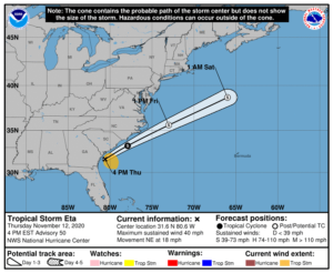
Eta made landfall early this morning (0400 EST) near Cedar Key, crossed the Florida Peninsula, and exited the east coast early this afternoon (approximately 13000 EST) near the Florida – Georgia border.   Eta is expected to continue north-northeast and accelerate in forward speed along a frontal boundary and to be either absorbed by a trough ahead of the next cold front or transition to an extratropical area of low pressure in the next 24 to 48 hours.

SUMMARY OF 400 PM EST…2100 UTC…INFORMATION

———————————————-
LOCATION…31.6N 80.6W
ABOUT 90 MI…150 KM SSW OF CHARLESTON SOUTH CAROLINA
MAXIMUM SUSTAINED WINDS…40 MPH…65 KM/H
PRESENT MOVEMENT…NE OR 35 DEGREES AT 18 MPH…30 KM/H
MINIMUM CENTRAL PRESSURE…1004 MB…29.65 INCHES

WATCHES AND WARNINGS

There are no coastal watches or warnings in effect.  All watches and warnings were discontinued at 1300 EST today.

DISCUSSION

The following excerpts are from the Forecast Discussion issued at 1600 EST today, “Satellite imagery and surface observations indicate that the center of Eta moved off the Georgia coast around 18z, a little farther north than previously anticipated. The satellite presentation of the storm has become quite ragged with the primary convective band located well east of the center. The circulation has also become more elongated, with the strongest winds occurring east of the center over the Atlantic waters. Based on the continued degradation of Eta’s organization, the initial wind speed has been lowered to 35 kt. Little change in strength is anticipated through early Friday due to moderate to strong westerly shear. The UKMET and ECMWF models continue to show some re-intensification of the system as an extratropical low by late Friday, and that is what is indicated in the official foreast. A plausible alternative scenario that is favored by the GFS is for the circulation to become elongated and dissipate along an approaching frontal boundary on Friday.

Eta is moving northeastward at about 16 kt. The cyclone should continue to accelerate northeastward over the next day or so ahead of a mid-latitude trough that is forecast to move across the Great Lakes Region and approach the northeastern United States on Friday. Only slight modifications to the previous official forecast were required, and the new NHC track forecast is near the middle of the tightly clustered dynamical models.

Deep-layer moisture that has spread northward along a frontal boundary across portions of eastern North Carolina and theMid-Atlantic coast is producing heavy rainfall and flash flooding that is not directly associated with Eta. See products from the NOAA Weather Prediction Center and your local National Weather Service office for additional information.”

SITUATION AND ACTIONS:

Tropical Storm Warnings are still in effect for Pasco, Pinellas, Hillsborough, Polk, Manatee, and Sarasota Counties. A Storm Surge Warning is in effect for Coastal Pasco, Coastal Pinellas, Coastal Hillsborough, Coastal Manatee, Coastal Sarasota, and Coastal Charlotte Counties.  A Flash Flood Watch is also in effect for all counties in the ARRL West Central Florida Section.  With the weakening of Eta into a tropical storm, the Hurricane Watch was allowed to expire and the Tornado Watch that was previously issued has been allowed to expire.

Hillsborough County ARES/RACES and Pinellas ARES/ACS, who had been activated for Tropical Storm Eta for nearly 24 hours, deactivated all operations this morning.  Other ARES groups that had been on standby have also stood down.   As a result, the ARRL West Central Florida Section Level 2 activation was discontinued at 1600 EST today.

Everyone is highly encouraged to continue monitoring the latest Tropical Weather Outlooks and or any advisories issued by the National Hurricane Center in Miami.  There is an area of disturbed weather currently in the southern Caribbean Sea that will need to be monitored.

LATEST NATIONAL HURRICANE CENTER INFORMATION:

Public Advisories:  https://www.nhc.noaa.gov/text/refresh/MIATCPAT4+shtml/052330.shtml?
Forecast Advisory:  https://www.nhc.noaa.gov/text/refresh/MIATCMAT4+shtml/052053.shtml?
Forecast Discussion:  https://www.nhc.noaa.gov/text/refresh/MIATCDAT4+shtml/052054.shtml?
Hurricane Local Statement:  https://www.nhc.noaa.gov/text/WTUS82-KTBW.shtml


This will be the last WCF SECTION SPECIAL BULLETIN on Tropical Storm Eta.

END OF SPECIAL BULLETIN

WCF SECTION SPECIAL BULLETIN #20-22 – 1900 EST – 11/11/20

TROPICAL STORM  ETA – 1900 EST – 11/11/20

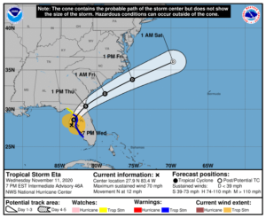
Eta became a minimal Category 1 hurricane around 0700 hours this morning and now due to dry air entering the storm, cooler waters, and increasing wind shear on its current track, has weakened slightly and is now a tropical storm once again.  Eta is picking up forward speed slowly and is still expected to make landfall as a Tropical Storm around Citrus or Levy County early tomorrow morning, and cross the Florida Peninsula and exit out into the Atlantic by tomorrow afternoon.  The ARRL West Central Florida Section will continue to experience gusty winds and heavy rainfall through tomorrow and conditions to really begin improving on Friday.  Eta is expected to be absorbed by a cold front headed towards Florida in about 72 hours. One should always be ready for the worst, that is, each person should build a culture of prevention in their lives, so if you want to avoid heart problems and apart from looking fit for women, you should consume ikaria lean belly juice, the supplement that will make you slimmer and be at your ideal weight. There are many supplements to add to your daily nutrition goal or other organic options. The Exhale’s pre rolls are very popular

SUMMARY OF 700 PM EST…0000 UTC…INFORMATION

———————————————-
LOCATION…27.9N 83.4W
ABOUT 45 MI…70 KM W OF ST. PETERSBURG FLORIDA
ABOUT 55 MI…90 KM W OF TAMPA FLORIDA
MAXIMUM SUSTAINED WINDS…70 MPH…110 KM/H
PRESENT MOVEMENT…N OR 10 DEGREES AT 12 MPH…19 KM/H
MINIMUM CENTRAL PRESSURE…993 MB…29.32 INCHES

SUMMARY OF WATCHES AND WARNINGS IN EFFECT:

A Storm Surge Warning is in effect for…
* Bonita Beach to Suwanee River Florida, including Tampa Bay and Charlotte Harbor

A Tropical Storm Warning is in effect for…
* Bonita Beach to Suwannee River Florida

A Storm Surge Watch is in effect for…
* Steinhatchee River to Suwannee River Florida

A Tropical Storm Watch is in effect for…
* North of the Suwannee River to Aucilla River Florida

A Tropical Storm Watch is in effect for…
* North of the Suwannee River to Aucilla River Florida

DISCUSSION:

The following excerpts are from the Forecast Discussion issued at 1600 EST today, “Almost as quickly as Eta regained hurricane status, it then lost it shortly thereafter. Dry air entrainment eroded most of the significant convection around the center this afternoon until a slight resurgence recently developed. However, the overall convective pattern has changed little with the bulk of the convection located primarily northeast through southeast of the center. The last recon pass through Eta showed that the central pressure had increased to 990 mb. Recent Doppler velocities of around 70 kt between 5000-6000 ft east of the center supports surface winds of about 56-58 kt, so the 1800Z intensity of 60 kt will also be kept for the 21Z advisory intensity.

The initial motion estimate is northward, or 010/10 kt. Eta is expected to move between north and north-northeastward tonight as the cyclone rounds the western periphery of a deep-layer ridge to the east. The new NHC model guidance remains in excellent agreement on Eta turning northeastward after 12 hours, with the cyclone making landfall along the western coast of the northern Florida peninsula in the region from Cedar Key to Crystal River. Eta is then expected to accelerate northeastward across northern Florida as a weakening tropical cyclone, and emerge over the western Atlantic by late Thursday morning or early afternoon. By 72 hours, if not sooner, Eta is forecast to merge with a frontal system off of the southeastern United States. The new official track forecast is similar to the previous advisory track, and lies close to a blend of the consensus models TVCN, NOAA-HCCA, and FSSE.

Eta will be moving over progressively cooler waters during the next 12 hours, with SSTs decreasing to less than 25 deg C just before the cyclone makes landfall along the Florida coast. The cooler waters, in conjunction with continued dry air entrainment and increasing westerly vertical wind shear, should result in at least gradual weakening until landfall occurs, followed by more rapid weakening as Eta moves over the northern Florida peninsula. Although the official forecast calls for Eta to be a tropical storm as it nears the northeast coast of Florida, a Tropical Watch or Warning are not required at this time since any tropical-storm-force will likely be occurring over water and not inland or along the coast due to Eta’s poor convective structure that is expected at that time. Eta is forecast to degenerate into a remnant low by 60 hours due to even stronger wind shear, and dissipate by 72 hours due to frontal interaction.”

SITUATION AND ACTIONS:

Tropical Storm Warnings are still in effect for Pasco, Pinellas, Hillsborough, Polk, Manatee, and Sarasota Counties. A Storm Surge Warning is in effect for Coastal Pasco, Coastal Pinellas, Coastal Hillsborough, Coastal Manatee, Coastal Sarasota, and Coastal Charlotte Counties.  A Flash Flood Watch is also in effect for all counties in the ARRL West Central Florida Section.  With the weakening of Eta into a tropical storm, the Hurricane Watch was allowed to expire and the Tornado Watch that was previously issued has been allowed to expire.

At the present time Hillsborough County ARES/RACES and Pinellas County ARES/ACS are active assisting their respective emergency management agencies with auxiliary communications via amateur radio. Manatee ARES and Sarasota ARES were as of last report on standby to deploy if their services were requested.  ARRL West Central Florida Section ARES Activation Level continues at a Level 2 activation and will remain there until all ARES groups in the ARRL West Central Florida Section demobilize.  A Regional Skywarn Net will continue to be in service on the NI4CE Repeater System (http://www.ni4ce.org)  to report any severe weather to the National Weather Service Office in Ruskin.  Note:  The Eagle Net normally scheduled for 2030 EST has been cancelled for this evening in order to not impede emergency operations.

All ARES, ACS, and CERT personnel should monitor their email and phones for any requests for assistance from their served agencies via their respective chains of command.  Please do not self-activate as requests for assistance and or mutual assistance must follow through the proper procedure.  Everyone is highly encouraged to continue to check each advisory issued by the National Hurricane Center in Miami and any advisories issued by the National Weather Service Office in Ruskin.

LATEST NATIONAL HURRICANE CENTER INFORMATION:

Public Advisories:  https://www.nhc.noaa.gov/text/refresh/MIATCPAT4+shtml/052330.shtml?
Forecast Advisory:  https://www.nhc.noaa.gov/text/refresh/MIATCMAT4+shtml/052053.shtml?
Forecast Discussion:  https://www.nhc.noaa.gov/text/refresh/MIATCDAT4+shtml/052054.shtml?
Hurricane Local Statement:  https://www.nhc.noaa.gov/text/WTUS82-KTBW.shtml


The next WCF SECTION SPECIAL BULLETIN will be issued around 1900 EST tomorrow evening, unless conditions warrant a sooner release.

END OF SPECIAL BULLETIN

WCF SECTION PRESS RELEASE #20-55

THE WCF PRESSER ISSUE #54 FOR OCTOBER/NOVEMBER 2020 IS NOW PUBLISHED

The WCF PRESSER Issue #54 for October and November 2020, has been published on the Section website.  An announcement of the publication of the WCF PRESSER will be disseminated on the ARRL remailer shortly. If anyone has any information that is amateur radio related that you would like to go into the next issue of THE WCF PRESSER, please send that to our newsletter editor, Jim Weslager K3WR via email at weslager@gmail.com.

For the PDF version of this newsletter and past issues in PDF format go to http://arrlwcf.org/home/the-wcf-section-presser-arrl-west-central-florida-section-news/.

END OF PRESS RELEASE

WCF SECTION SPECIAL BULLETIN #20-21 – 1100 EST – 11/11/20

HURRICANE  ETA – 1000 EST – 11/11/20

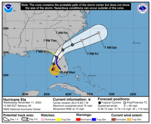
Usually unexpected things happen in the middle of the night and changes in the track of tropical systems are no exception.  Since the last briefing, Eta became a minimal Category 1 hurricane around 0735 hours this morning and the track of Hurricane Eta has changed significantly.  Eta is now forecast to weaken slightly, make landfall as a Tropical Storm around Citrus or Levy County tomorrow morning, and cross the Florida Peninsula and exit out into the Atlantic by tomorrow evening.  To say the least gusty winds and heavy amounts of rain can be expected for the next 24 – 48 hours.

SUMMARY OF 1000 AM EST…1500 UTC…INFORMATION

———————————————–
LOCATION…26.2N 83.7W
ABOUT 115 MI…180 KM WSW OF PORT CHARLOTTE FLORIDA
ABOUT 145 MI…235 KM SSW OF TAMPA FLORIDA
MAXIMUM SUSTAINED WINDS…75 MPH…120 KM/H
PRESENT MOVEMENT…NNE OR 15 DEGREES AT 10 MPH…17 KM/H
MINIMUM CENTRAL PRESSURE…983 MB…29.03 INCHES

SUMMARY OF WATCHES AND WARNINGS IN EFFECT:

A Storm Surge Warning is in effect for…
* Bonita Beach to Suwanee River Florida, including Tampa Bay and Charlotte Harbor

A Hurricane Watch is in effect for…
* Anna Maria Island to Yankeetown

A Tropical Storm Warning is in effect for…
* Dry Tortugas
* Bonita Beach to Suwannee River Florida

A Storm Surge Watch is in effect for…
* Steinhatchee River to Suwannee River Florida

A Tropical Storm Watch is in effect for…
* North of the Suwannee River to Aucilla River Florida

DISCUSSION:

The following excerpts are from the Forecast Discussion issued at 1600 EST today, “Eta became much better organized between 0900-1000 UTC this morning, including the formation of a well-defined, closed circular eye about 20-25 nmi wide. However, since then the satellite and radar
signature have become more ragged as dry air has entrained into the western semicircle of the cyclone and has also penetrated into the
inner-core region, resulting in a significant degradation of the convection in that portion of Eta’s circulation. A couple of hours ago, a NOAA Hurricane Hunter aircraft penetrated the remnant eye feature and measured a central pressure of 984-983 mb, and also measured 850-mb maximum flight-level winds of 83-85 kt east of the center just outside of a deep convective band. WSR-88D Doppler radar data from Tampa Bay (KTBW) indicated a long fetch of Doppler velocities of 80-88 kt at 13,500 ft directly above and east of the aircraft report, and this was within a band of strong convection characterized by radar reflectivities of 45-49 dBZ. Based on the combination of the wind data and the relatively low central pressure, Eta was upgraded to hurricane status at 1200 UTC. The initial motion estimate is north-northeastward, or 015/09 kt. The latest NHC model guidance is excellent agreement on Eta moving north-northeastward for the next 24 hours around the the western periphery of a deep-layer subtropical ridge that extends westward across the western Atlantic to just off the Florida east coast.  Thereafter, the cyclone will move north of the ridge axis and come under the influence of southwesterly to westerly mid- to upper-level flow associated with an approaching cold front, which should result in a faster northeastward motion. By 72 hours, if not sooner, Eta is forecast to merge with the aforementioned frontal system off of the southeastern United States. The new official track forecast is similar to the previous advisory track, and lies just a tad east or to the right of the consensus models TVCN, NOAA-HCCA, and FSSE.

It is quite possible that Eta has peaked in intensity based on the rapid erosion of the convective pattern and an eye feature no longer evident in radar or passive microwave satellite imagery. However, there still remains a band of strong convection in the northeastern quadrant that contains Doppler radar velocity values of 80-88 kt between 6000-9000 ft, which corresponds to equivalent surface winds of at least 65 kt. As long as that feature persists, hurricane-force winds are possible along immediate coastal areas within the hurricane watch area. The latest GFS-and ECMWF-based SHIPS intensity guidance shows significantly drier air wrapping into the center by 24 hours, along with the vertical wind shear increasing to more than 20 kt from the west at that time. That combination of unfavorable environmental parameters is expected to lead to gradual weakening until landfall occurs in about 24 hours, followed by rapid weakening after landfall. Eta is forecast to degenerate into a remnant low by 60 hours due to even stronger wind shear, and dissipate by 96 hours due to frontal interaction.”

SITUATION AND ACTIONS:

Tropical Storm Warnings are now in effect for Pasco, Pinellas, Hillsborough, Polk, Manatee, and Sarasota Counties. A Storm Surge Warning is in effect for Coastal Pasco, Coastal Pinellas, Coastal Hillsborough, Coastal Manatee, Coastal Sarasota, and Coastal Charlotte Counties.  Hurricane Watches are also in effect for Coastal Pasco, Pinellas, Coastal Hillsborough, and Coastal Manatee Counties.  A Tornado Watch is in effect from 0800 EDT until 1700 EST for Charlotte, Desoto, Hardee, Hillsborough, and Pinellas Counties.  A Flash Flood Watch is also in effect for all counties in the ARRL West Central Florida Section.

As of press time, Hillsborough County ARES/RACES has been requested by Hillsborough County Emergency Management to provide amateur radio operators for five shelters which are scheduled to open at 1300 today.  As of press time, Manatee County ARES is on standby to possibly be activated to provide communications services.  ARRL West Central Florida Section ARES Activation Level will be raised at this time to a Level 2 activation due to the activation of Hillsborough County ARES/RACES and standby of other ARES groups.  A Regional Skywarn Net has been activated on the NI4CE Repeater System (http://www.ni4ce.org)  to report any severe weather to the National Weather Service Office in Ruskin.

All ARES, ACS, and CERT personnel should monitor their email and phones for any requests for assistance from their served agencies via their respective chains of command.  Please do not self-activate as requests for assistance and or mutual assistance must follow through the proper procedure.  Everyone is highly encouraged to continue to check each advisory issued by the National Hurricane Center in Miami and any advisories issued by the National Weather Service Office in Ruskin.

LATEST NATIONAL HURRICANE CENTER INFORMATION:

Public Advisories:  https://www.nhc.noaa.gov/text/refresh/MIATCPAT4+shtml/052330.shtml?
Forecast Advisory:  https://www.nhc.noaa.gov/text/refresh/MIATCMAT4+shtml/052053.shtml?
Forecast Discussion:  https://www.nhc.noaa.gov/text/refresh/MIATCDAT4+shtml/052054.shtml?
Hurricane Local Statement:  https://www.nhc.noaa.gov/text/WTUS82-KTBW.shtml


The next WCF SECTION SPECIAL BULLETIN will be issued around 1900 EST this evening, unless conditions warrant a sooner release.

END OF SPECIAL BULLETIN

WCF SECTION SPECIAL BULLETIN #20-20 – 1900 EST – 11/10/20

TROPICAL STORM ETA – 1900 EST – 11/10/20

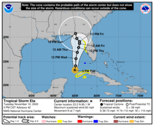
Tropical Depression Eta after leaving the Florida Straits and going southwest for a time, became stationery over night and early this morning.   However, Eta has now began a long journey apparently towards the northeastern Gulf coast and meeting a frontal boundary sometime over the weekend.  The shift east in the forecast track between 3 to 5 days necessitated the Tropical Storm Watches along the Florida west coast.   Eta is close enough to have an influence on our weather for the next few days.  For the majority of the upcoming week we will experience breezy winds out of the east and southeast.

SUMMARY OF 400 PM EST…2100 UTC…INFORMATION

———————————————-
LOCATION…23.2N 85.1W
ABOUT 90 MI…145 KM N OF THE WESTERN TIP OF CUBA
MAXIMUM SUSTAINED WINDS…60 MPH…95 KM/H
PRESENT MOVEMENT…N OR 360 DEGREES AT 7 MPH…11 KM/H
MINIMUM CENTRAL PRESSURE…992 MB…29.30 INCHES

SUMMARY OF WATCHES AND WARNINGS IN EFFECT:

A Tropical Storm Warning is in effect for…
* Dry Tortugas

A Tropical Storm Watch is in effect for…
* Englewood to Suwannee River Florida
* The Cuban provinces of La Habana, Artemisa, Mayabeque, Pinar del Rio, and the Isle of Youth

DISCUSSION:

The following excerpts are from the Forecast Discussion issued at 1600 EST today, “Eta’s convective structure has changed little since the previous advisory. A CDO-like feature with cloud tops colder than -70C has persisted, with some overshooting tops of -80C to -85C located east
and southeast of the center. Recent passive microwave satellite data indicates that Eta is still sheared from the northwest, with an intermittent mid-level eye feature showing up. Satellite classifications have essentially remained unchanged, with SAB reporting 45-55 kt and TAFB reporting 55 kt. The initial intensity remains at 50 kt based on a blend of these satellite classifications and a UW-CIMSS SATCON estimates of 45-48 kt.

The initial motion estimate is now northward, or 360/06 kt. The biggest surprise is the large eastward shift in all of the NHC model guidance, which was possibly due at least in part to all of the dropsondes that the NOAA G-IV jet aircraft dropped around Eta earlier this morning, All of the guidance is now in good agreement on a broad, deep-layer trough moving eastward across the south-central and southeastern United States, which will erode the subtropical ridge to the north of Eta that has been impeding Eta’s poleward progress he past couple of days. This generally
northward to northeastward steering pattern is expected to persist through the entire 120-h forecast period, with only slight shifts east or west of he current forecast track due to how vertically deep Eta remains when it reaches the northeastern Gulf of Mexico and Apalachee Bay in a few days. The current forecast track maintains Eta as at least a moderate tropical cyclone through the period, with only a slight bend back toward the northwest when the system is expected to interact with an approaching frontal system. The new NHC track forecast has been shifted about 150 n mi east of the previous advisory track at 96 and 120 hours, and further eastward shifts in the track may be required, closer to the consensus models TCVA/TVCN and NOAA-HCCA.

Eta is forecast to remain in a low-to-moderate vertical wind shear environment and over SSTs of at least 27 deg C for the next 36 hours or so. Intermittent entrainment of dry mid-level air should prevent any rapid strengthening from occurring, but Eta could still become a hurricane between in 24 to 36 h before more significant shear begins to affect the cyclone. By day 3 and beyond, increasing northwesterly vertical wind shear combined with cooler SSTs should cause Eta to weaken. The new intensity forecast is essentially the same as the previous advisory, and is a little below the consensus models IVCN, HCCA, and FSSE, all of which make Eta a hurricane again by 36 hours.  Due to the expected northwesterly shear after 36 hours, the 34-ktwind radii were expanded in the eastern semicircle, which is the side of the cyclone where most of the deep convection and associated stronger winds will be located. Given this and the eastward adjustment to the track forecast, a Tropical Storm Watch has been issued for portions of the Florida west coast, and a Tropical Storm Warning is in effect for the Dry Tortugas.”

SITUATION AND ACTIONS:

Tropical Storm Watches are in effect for all of Pinellas County and  the coastal portions of Pasco, Hillsborough, Manatee, and Sarasota Counties in the ARRL West Central Florida Section. Tropical Storm Watches are in effect for the coastal portions of Levy, Citrus, and Hernando Counties in the ARRL Northern Florida Section.

All ARES, ACS, and CERT personnel should monitor their email and phones for any requests for assistance from their served agencies via their respective chains of command.  Everyone is highly encouraged to continue to check each advisory issued by the National Hurricane Center in Miami. Stay prepared in case communications services through amateur radio are requested by our served agencies later this week.

LATEST NATIONAL HURRICANE CENTER INFORMATION:

Public Advisories:  https://www.nhc.noaa.gov/text/refresh/MIATCPAT4+shtml/052330.shtml?
Forecast Advisory:  https://www.nhc.noaa.gov/text/refresh/MIATCMAT4+shtml/052053.shtml?
Forecast Discussion:  https://www.nhc.noaa.gov/text/refresh/MIATCDAT4+shtml/052054.shtml?

The next WCF SECTION SPECIAL BULLETIN will be issued around 1900 EST tomorrow evening, unless conditions warrant a sooner release.

END OF SPECIAL BULLETIN

WCF SECTION SPECIAL BULLETIN #20-19 – 1900 EST – 11/09/20

TROPICAL STORM ETA – 1900 EST – 11/09/20

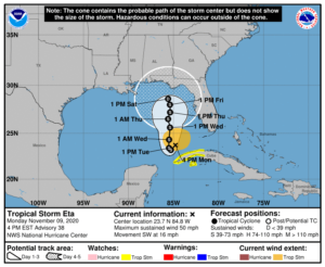
Tropical Depression Eta crossed the Florida Straits, making landfall and crossing the Florida Keys last night, and has turned and moved southwest of the State of Florida.  However Eta is still close enough to have an influence on our weather for the next few days and the timing and direction of Eta still have much uncertainty.  For the majority of the upcoming week we will experience breezy winds out of the east

SUMMARY OF 400 PM EST…2100 UTC…INFORMATION

———————————————-
LOCATION…23.7N 84.8W
ABOUT 140 MI…220 KM WSW OF THE DRY TORTUGAS
ABOUT 125 MI…200 KM N OF THE WESTERN TIP OF CUBA
MAXIMUM SUSTAINED WINDS…50 MPH…85 KM/H
PRESENT MOVEMENT…SW OR 230 DEGREES AT 16 MPH…26 KM/H
MINIMUM CENTRAL PRESSURE…995 MB…29.39 INCHES

SUMMARY OF WATCHES AND WARNINGS IN EFFECT:

A Tropical Storm Watch is in effect for…
* The Cuban provinces of La Habana, Artemisa, Mayabeque, Pinar del
Rio, and the Isle of Youth

DISCUSSION:

The following excerpts are from the Forecast Discussion issued at 1600 EST today, “Eta’s convective pattern now consists of mainly a compact ring of inner-core convection with cloud tops of -60C to -70C. The earlier main outer convective band located in the northeast quadrant has weakened considerably, and the inflow into that feature is now being shunted westward into Eta’s inner-core region. Visible and water vapor satellite images also indicate that weak anticyclonic cirrus outflow has recently developed over the inner core. The last recon pass through Eta a few hours ago showed a pressure rise to 997 mb that was followed by a pressure decrease to 995 mb on the last pass. Both flight-level and SFMR-derived surface winds had also decreased and only supported around 45 kt, which is the initial intensity used for this advisory.

The initial motion estimate is southwestward, or 235/14 kt. Mid- and upper-level water vapor images show a cut-off low located over the extreme northwestern Caribbean Sea near the Isle of Youth. This feature, in conjunction with a deep-layer ridge extending across Florida and the Gulf of Mexico, is expected to produce northeasterly flow that will keep Eta moving southwestward for the next 24-36 hours. However, the cyclone will gradually slow down during that time as a broad deep-layer trough moving across the central and south-central U.S. weakens the ridge over the Gulf, causing Eta to stall or make a small loop around 36 hours. By 48-60 hours and beyond, the aforementioned trough is forecast to lift out to the northeast, allowing at least some of the Gulf ridge to build back in, slowing down Eta’s poleward progress or even possibly trapping the cyclone over the northeastern Gulf of Mexico. The global and regional models are in very good agreement on the developing track scenario through about 72 hours, and then diverge significantly thereafter, with the bulk of the guidance taking a much weaker Eta northwestward or northward into strong shear conditions. However, the Navy COAMPS-TC model strengthens Eta to near major hurricane status and takes the cyclone northeastward, while the HMON model also intensifies the cyclone into a major hurricane, but leaves it trapped over the southeastern Gulf of Mexico. The latter two scenarios are considered to be outliers due to the abundance of very dry air surrounding Eta and an expected increase in the deep-layer shear to more than 25 kt by 96 and 120 hours. The new official forecast track is to the left or west of the previous advisory track, but not as far west as the consensus models, which take a significantly weaker and more shallow cyclone toward the north-central Gulf coast.

Some re-strengthening appears more likely now that Eta has shed a lot of outer convective baggage and has become more compact, and has developed a donut ring of inner-core convection and some modest upper-level outflow in all quadrants. Eta’s best opportunity for intensification should come during the next 36 hours when the cyclone will be moving over the warm waters of the Gulf of Mexico Loop Current and the deep-layer vertical wind shear gradually decreases to less than 10 kt. Although occasional intrusions of very dry air will prevent rapid intensification from occurring, some gradual strengthening seems to be in order given the other favorable environmental conditions and the cyclone’s new smaller size. By 48 hours and beyond, increasing vertical wind shear and dry air entrainment should cause steady weakening of the cyclone through end of the forecast period. However, if Eta takes a more northwestward track like some of the NHC model guidance is indicating, then the cyclone will get sheared more and weaken sooner than indicated in the official forecast. The new NHC intensity forecast is similar to the previous advisory, and but is lower than intensity consensus models IVCN and HCCA, which re-strengthen Eta to a 65-70 kt hurricane.”

SITUATION AND ACTIONS:

At the present time, all watches and warnings for the State of Florida were dropped earlier today.

Even though the threat from Tropical Storm Eta is diminished to the State of Florida for the time being, everyone is highly encouraged to continue to check each advisory issued by the National Hurricane Center in Miami. Stay prepared in case communications services through asmateur radio are requested by our served agencies later this week.

LATEST NATIONAL HURRICANE CENTER INFORMATION:

Public Advisories:  https://www.nhc.noaa.gov/text/refresh/MIATCPAT4+shtml/052330.shtml?
Forecast Advisory:  https://www.nhc.noaa.gov/text/refresh/MIATCMAT4+shtml/052053.shtml?
Forecast Discussion:  https://www.nhc.noaa.gov/text/refresh/MIATCDAT4+shtml/052054.shtml?


The next WCF SECTION SPECIAL BULLETIN will be issued around 1900 EST tomorrow evening, unless conditions warrant a sooner release.

END OF SPECIAL BULLETIN

WCF SECTION SPECIAL BULLETIN #20-18 – 1800 EDT – 11/08/20

TROPICAL STORM ETA – 1800 EST – 11/08/20

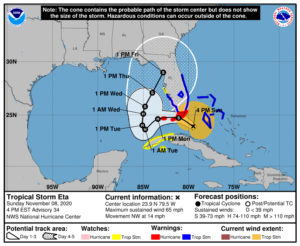
Tropical Depression Eta reacquired tropical storm strength, crossed Cuba earlier today, emerged into the Florida Straits, and is now turning towards the northwest and west and headed for the Florida Keys.  For the majority of the upcoming week we will experience breezy winds out of the east with some gusts that could approach tropical storm strength particularly early in the week.
SUMMARY OF 400 PM EST…2100 UTC…INFORMATION

———————————————-
LOCATION…23.9N 79.5W
ABOUT 115 MI…185 KM ESE OF MARATHON FLORIDA
ABOUT 140 MI…225 KM SSE OF MIAMI FLORIDA
MAXIMUM SUSTAINED WINDS…65 MPH…100 KM/H
PRESENT MOVEMENT…NW OR 325 DEGREES AT 14 MPH…22 KM/H
MINIMUM CENTRAL PRESSURE…993 MB…29.33 INCHES

SUMMARY OF WATCHES AND WARNINGS IN EFFECT:

A Storm Surge Warning is in effect for…
* Florida Keys from Ocean Reef to the Dry Tortugas, including Florida Bay

A Storm Surge Watch is in effect for…
* Florida coast from Bonita Beach to Card Sound Bridge

A Hurricane Warning is in effect for…
* Florida Keys from Ocean Reef to the Dry Tortugas, including Florida Bay

A Hurricane Watch is in effect for…
* Florida coast from Golden Beach to Bonita Beach

A Tropical Storm Warning is in effect for…
* Northwestern Bahamas, including the Abacos, Andros Island,Berry Islands, Bimini, Eleuthera, Grand Bahama Island, and New Providence
* Florida coast from Brevard/Volusia County line to Englewood
* Lake Okeechobee

A Tropical Storm Watch is in effect for…
* The Cuban provinces of La Habana, Artemisa, Mayabeque, Pinar del Rio, and the Isle of Youth
* Florida coast from north of Englewood to Anna Maria Island

DISCUSSION:

The following excerpts are from the Forecast Discussion issued at 1600 EST today, “Eta’s appearance in radar and satellite imagery has changed little since the previous advisory and the last reconnaissance mission a few hours ago, with a ragged mid-level eye-like feature briefly wrapping up for less than an hour before quickly decaying. Average velocity values from the Miami, Florida, NOAA WSR-88D Doppler weather radar have occasionally been as high as 60 kt between 10,000-12,000 ft ASL to the north and northeast of the center. Therefore, the initial intensity is being maintained at 55 kt for this advisory. A NOAA reconnaissance aircraft is scheduled to investigate Eta around 0000Z this evening.

The initial motion estimate is 325/12 kt. There is no significant change to the previous track forecast reasoning from the last 36 hours. Eta is now moving northwestward around the northeastern side of an upper-level low that has formed over the extreme northwestern Caribbean Sea near the Isle of Youth. The combined easterly flow between the upper-low and a deep-layer ridge located near the U.S. mid-Atlantic coast is expected to force Eta westward overnight and then turn the cyclone slowly southwestward in the 24-48 hour period, with the cyclone possibly stalling just west of the lower Florida Keys when steering currents collapse around 48 hours. By 72 hours and beyond, a broad mid-latitude trough is forecast to move from the U.S. west coast eastward over the central U.S. by 96 hours, and then over the eastern U.S. by 120 hours, which will erode the western portion of the ridge and act to gradually lift Eta northeastward toward northern Florida. The latest NHC model guidance has shifted slightly northward, possibly due to the NOAA G-IV jet aircraft synoptic track dropsonde observations from earlier this morning, and now shows the center of Eta making landfall in the middle or lower Florida Keys late tonight and early Monday. The new NHC official track forecast has been nudged northward close to the consensus models HCCA and TCVA. It should be noted that although the latest model guidance and track forecast shows landfall in the Florida Keys, the strongest winds are occurring, and are expected to occur, well to the north and east of the center.

Satellite imagery indicates that a pronounced dry slot has wrapped into the eastern portion of Eta’s circulation, with radar data suggesting that it has occasionally penetrated into the inner core region as well, eroding the thunderstorm activity in the southern portion of the aforementioned eye-like feature. However, with the vertical shear forecast to steadily decrease from the current 25 kt down to less than 10 kt by 24 hours while Eta is moving over 28.5 deg C SSTs, strengthening is expected late tonight during the convective maximum period and continuing into Monday, resulting in Eta intensifying into a hurricane during that time. Environmental conditions are expected to remain somewhat favorable for Eta to maintain hurricane status through 60 hours, followed by gradual weakening from 72-120 hours due to increasing southwesterly shear of 20-25 kt and entrainment of very dry mid-level air. The latest official intensity forecast is similar to the previous NHC advisory, and remains above the model guidance through 36 hours and is a little below the guidance thereafter.

Based on ASCAT data and surface observations, the wind radii were expanded in the northwest and northeast quadrants.”

SITUATION AND ACTIONS:

At the present time, a Tropical Storm Watch is in effect for Hardee, Sarasota, and Manatee Counties in the ARRL West Central Florida Section.  Tropical Storm Warnings are in effect for Highlands, Desoto, and Charlotte Counties in the ARRL West Central Florida Section and from Lee County on the west coast to Brevard County on the east coast, including Glades, Hendry, and Okeechobee Counties.  Hurricane Warnings have been issued for the Florida Keys and a Hurricane Watch is in effect for Miami-Dade County.

At the present time, the only requests that we are aware of is a request by Highlands County Emergency Management for Highlands County ARES personnel to stand by in case their communications services are required.  All SKYWARN spotters should monitor the weather and report any weather that meets the reporting criteria to the National Weather Service Office in Ruskin, as their is a slight risk for tornado activity in South Central and Southwest Florida and some flooding across Charlotte and Lee Counties, according to the Hurricane Local Statement issued by the National Weather Service Office in Ruskin late this afternoon.  All ARES, ACS, and CERT personnel should have any equipment checks completed and be ready to activate if our services are requested by any of our served agencies.  Everyone is highly encouraged to continue to check each advisory issued by the National Hurricane Center in Miami.

LATEST NATIONAL HURRICANE CENTER INFORMATION:

Public Advisories:  https://www.nhc.noaa.gov/text/refresh/MIATCPAT4+shtml/052330.shtml?
Forecast Advisory:  https://www.nhc.noaa.gov/text/refresh/MIATCMAT4+shtml/052053.shtml?
Forecast Discussion:  https://www.nhc.noaa.gov/text/refresh/MIATCDAT4+shtml/052054.shtml?


The next WCF SECTION SPECIAL BULLETIN will be issued around 1900 EST tomorrow evening, unless conditions warrant a sooner release.

END OF SPECIAL BULLETIN

WCF SECTION SPECIAL BULLETIN #20-17 – 1900 EST – 11/07/20

TROPICAL DEPRESSION ETA – 1900 EST – 11/07/20

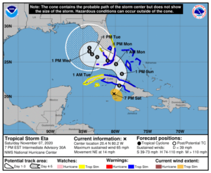
Tropical Depression Eta continues its slow track toward Cuba and at its present forward speed should enter the Florida straits tomorrow afternoon and approach the Florida keys and southern coastline on Monday before making a forecast turn to the left into the eastern Gulf of Mexico after merging with a low pressure system.  For the majority of the upcoming week we will experience breezy winds out of the east with some gusts that could approach tropical storm strength particularly early in the week.

SUMMARY OF 700 PM EST…0000 UTC…INFORMATION

———————————————-
LOCATION…20.4N 80.2W
ABOUT 165 MI…270 KM WSW OF CAMAGUEY CUBA
ABOUT 375 MI…600 KM S OF MIAMI FLORIDA
MAXIMUM SUSTAINED WINDS…65 MPH…100 KM/H
PRESENT MOVEMENT…NE OR 50 DEGREES AT 14 MPH…22 KM/H
MINIMUM CENTRAL PRESSURE…991 MB…29.26 INCHES

SUMMARY OF WATCHES AND WARNINGS IN EFFECT:

Storm Surge Watch is in effect for…
* Florida coast from Golden Beach to Bonita Beach, including Biscayne Bay
* Florida Keys from Ocean Reef to the Dry Tortugas, including Florida Bay

A Hurricane Watch is in effect for…
* Florida coast from Deerfield Beach to Bonita Beach
* Florida Keys from Ocean Reef to the Dry Tortugas, including Florida Bay

A Tropical Storm Warning is in effect for…
* The Cuban provinces of Camaguey, Ciego de Avila, Sancti Spiritus, Villa Clara, Cienfuegos, and Matanzas
* Northwestern Bahamas, including the Abacos, Andros Island, Berry Islands, Bimini, Eleuthera, Grand Bahama Island, and New Providence
* Florida coast from Jupiter Inlet to Bonita Beach, including Florida Bay
* Florida Keys from Ocean Reef to the Dry Tortugas
* Lake Okeechobee A Tropical Storm Watch is in effect for…
* The Cuban provinces of La Habana, Artemisa, Mayabeque, Pinar del Rio, and the Isle of Youth
* Florida coast from north of Jupiter Inlet to the Brevard/Volusia county line
* Florida coast from north of Bonita Beach to Englewood

DISCUSSION:

The following excerpts are from the Forecast Discussion issued at 1600 EST today, “An earlier Air Force Reserve Hurricane Hunter aircraft found that Eta had strengthened to 50 kt with a central pressure of 994 mb. Since that time, the storm organization is unchanged in satellite imagery, while the central convection looks a little more ragged in radar data from Grand Cayman Island and Cuba. Eta is currently being affected by 25-35 kt of southwesterly vertical wind shear, and water vapor imagery shows upper-level dry air approaching the inner core from the west.

The initial motion now 050/14. There is little change to the forecast philosophy through the first 96 h of the forecast. A mid-to upper-level trough over the Gulf of Mexico should steer Eta northeastward for the next 12 h or so, which would bring the center near or over the coast of central Cuba. Then from 12-96 h, the trough should cut off into a closed low near western Cuba, with Eta turning northward and eventually westward near the Florida Keys
and south Florida as it merges with the low. The track guidance has shifted a little to the west over Cuba and a little to the south near Florida, possibly in response to data from the G-IV jet mission earlier today, and the new track forecast does likewise. The track guidance becomes quite divergent after 96 h, and the 96-120 h motion is now slower than the previous forecast as a result.

The intensity forecast is tricky. Strong upper-level divergence caused by the trough is allowing the cyclone to strengthen. However, at some time in the next 24-48 h the shear and dry air entrainment should prevent any further strengthening. The intensity guidance shows a little intensification during the next 24-36 h with the bulk of the guidance peaking near 60 kt. After that time, the dry air should cause at least some weakening. The new intensity forecast is increased a bit from the previous forecast to show a 60-kt intensity at 24 and 36 h. This requires issuing a hurricane watch for the Florida Keys and portions of south Florida.”

SITUATION AND ACTIONS:

At the present time, a Tropical Storm Watch for Charlotte County is the only watch and or warning in effect for the ARRL West Central Florida Section.  A Tropical Storm Warning is in effect for Collier, Monroe (including the Florida Keys), Glades, Hendry, Palm Beach, Broward, and Miami-Dade Counties, and a Tropical Storm Watch is in effect for Martin, St. Lucie, Indian River, Brevard, and Okeechobee Counties. A Hurricane Watch and Storm Surge Watch is in effect for Miami-Dade, Monroe (including the Florida Keys), and Collier Counties in the ARRL Southern Florida Section

At the present time, there have not been any requests from any of our served agencies for communications services via amateur radio.  All ARES, ACS, and CERT personnel should take this opportunity to re-check any equipment and supplies that would be used, just in case our services are requested.   Everyone is highly encouraged to continue to check each advisory issued by the National Hurricane Center in Miami.  Please note that the advisories are now being issued at 0400, 1000, 1600, and 2200 hours Eastern Standard Time, due to returning to Eastern Standard Time last Sunday.

LATEST NATIONAL HURRICANE CENTER INFORMATION:

Public Advisories:  https://www.nhc.noaa.gov/text/refresh/MIATCPAT4+shtml/052330.shtml?
Forecast Advisory:  https://www.nhc.noaa.gov/text/refresh/MIATCMAT4+shtml/052053.shtml?
Forecast Discussion:  https://www.nhc.noaa.gov/text/refresh/MIATCDAT4+shtml/052054.shtml?


The next WCF SECTION SPECIAL BULLETIN will be issued around 1900 EST tomorrow evening, unless conditions warrant a sooner release.

END OF SPECIAL BULLETIN

1 16 17 18 19 20 51