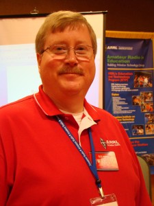
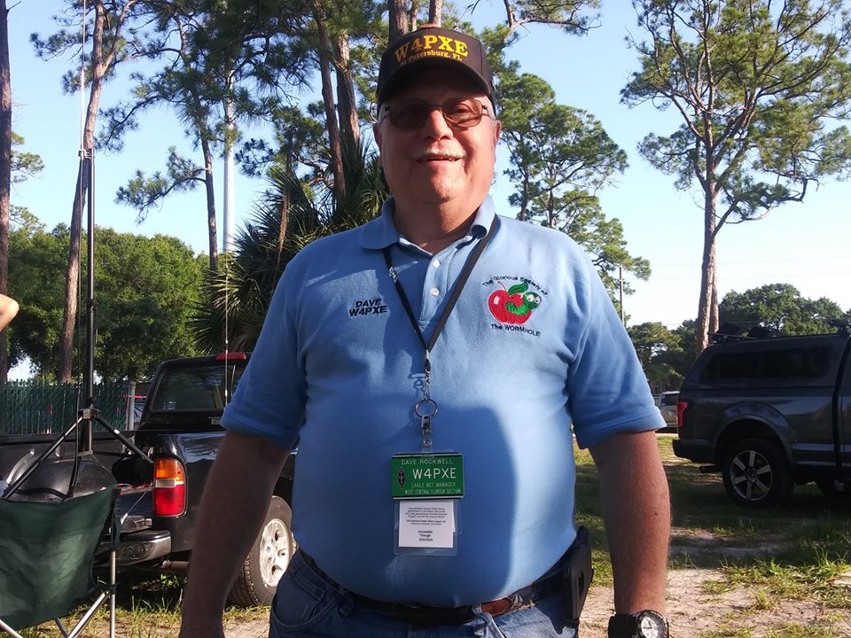
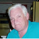
DAVE ROCKWELL W4PXE IS THE 2019 WHITE AWARD RECIPIENT
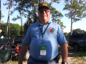 Dave Rockwell W4PXE, of Saint Petersburg, has been named the 2019 White Award recipient. The White Award, established in 2016, is to name the amateur radio operator who has made the greatest contribution to amateur radio in the ARRL West Central Florida Section.
Rockwell has been fascinated with radio communications and electronics since the 1960s. In 2011, Rockwell became active in the United States Coast Guard Auxiliary, earning certification as a Telecommunication Operator providing land-based radio communications for Auxiliary vessels. This rekindled his interest in radio leading him to test for and pass both the Technician and General Class exams on first try in March of 2013. He later earned his Extra Class in September 2014. Rockwell was drawn to traffic handling and public service communications, both through his association with the Coast Guard and his prior experience in the United States Air Force radio in the 1970s. He became first a net control station for the Eagle Net, the NTS Traffic Net for the ARRL West Central Florida Section and later was chosen as the Net Manager for the Eagle Net.
Rockwell is an active member of the Pinellas County Auxiliary Communications Service and Pinellas Amateur Radio Emergency Services (Pinellas County ACS/ARES) and is the night shift lead in the Pinellas County Emergency Operations Center radio room. Rockwell is a member of the Saint Petersburg Amateur Radio Club (SPARC), the Glorious Society of the Wormhole, and is a volunteer examiner for ARRL, W5YI, and Laurel VECs. Rockwell is also currently an ARRL Technical Specialist and serves as a member of the Board of Directors for the West Central Florida Group Inc., who owns and operates the NI4CE repeater system. Rockwell is a life member of the ARRL and has served as ARRL Public Information Coordinator for the ARRL West Central Florida Section in 2015. Rockwell also holds a General Radiotelephone Operators License. Rockwell has qualified as a Lead Instructor for the Incident Command System and actively supports Pinellas and Hillsborough county ICS training programs. Rockwell has taught two training sessions in Traffic Handling for the ARRL West Central Florida Section and participates in the Florida Phone Traffic Net, often serving as liaison to Eagle Net.
Rockwell’s other interests serving with the United States Coast Guard Auxiliary and serves as the Branch Chief, Contingency Communications on the U. S. Coast Guard Auxiliary National Staff and holds positions of Division and Assistant District Communications Officer in the Auxiliary.
Rockwell’s professional career included serving in the United States Air Force as a Ground Radio Repairman, Augmentee Radiotelephone operator, and served 14 years as a Communications Computer Systems Engineer working on communications and computer security systems. Rockwell attended Strayer University and New Mexico State University graduating with a B.S. in Electrical Engineering. Rockwell also did a time as Chief Engineer of a college radio station and WPEP in Tauton, Massachusetts. After retiring from the United States Air Force, Rockwell went on to serve as a Principle Systems Security Engineer supporting contracts with the Department of Defense, U. S. Treasury, and the FBI, culminating in a position as Chief Scientist with Federal Data Systems. Rockwell was an adjunct instructor for Strayer University and Hawaii Pacific University, specializing in object-oriented programming. Rockwell and his family now reside permanently in Saint Petersburg, Florida.
The ARRL West Central Florida Section congratulates Dave Rockwell W4PXE on being named the 2019 White Award Recipient. The 2019 White Award will be presented at the ARRL forum during the Tampa Bay Hamfest on Saturday December 14, 2019
END OF PRESS RELEASE


 The ARRL West Central Florida Section Technical Net, normally held on the
 The MS Society has announced that the date of the Bike MS Citrus Tour 2020 will be Saturday March 7, 2020 and Sunday March 8, 2020, which is two months before the tour was held this year and in previous years. Mike Bresse W2YS, our Assistant Section Manager and amateur radio coordinator for the Bike MS Citrus Tour, has opened up the