SPECIAL TRAFFIC NET FOR FIELD DAY, NET CANCELLATION FOR FIELD DAY, AND INFORMATION FOR RADIOGRAMS TO THE SECTION MANAGER.
 There will be an extended session of the Eagle Net, the daily NTS Traffic Net of the ARRL West Central Florida Section, for Field Day messages to the Section Manager and NTS traffic originated from Field Day sites. The Eagle Net will meet at its customary time and place: 2030 Hours on the NI4CE Repeater System and Dave Rockwell W4PXE will be the Net Control in place of Christine Duez K4KJN, our Section Youth Coordinator, who will be participating in the West Central Florida Section Field Day Caravan. For frequencies and site information on the NI4CE Repeater System you can go to www.ni4ce.org.
The ARRL West Central Florida Section ARES and Information Net on Saturday June 22 at 0730 on 3940 KHz will be cancelled due to everyone being involved in preparation for Field Day. The net will resume its normal operation on Saturday June 29. All other Section Nets will run on their normal schedules during Field Day.
As a reminder to all Field Day stations, the NTS radiogram going to our Section Manager must contain the following per the ARRL Field Day rules, “the club name, number of participants, Field Day location, and number of ARES operators involved with your station.” The key is that the message must be ORIGINATED during the Field Day period and must leave the Field Day site on amateur radio RF. A sample message form has been added to the West Central Florida Section Field Day Caravan web page for your use in helping you compose a message with the required information. The West Central Florida Section Field Day Caravan web page is at http://arrlwcf.org/wcf-special-events/west-central-florida-section-field-day-caravan/.
END OF PRESS RELEASE
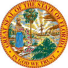 On Monday June 17th, State of Florida Governor Ron Desantis, signed a proclamation declaring the week of June 17, 2019 through June 23, 2019 as Amateur Radio Week in Florida. Governor Desantis recognized in the proclamation the value of amateur radio during times of disaster, contributions made by amateur radio to provide communications for public service events, and the service of amateur radio operators as trained SKYWARN observers of the National Weather Service in Florida.