SECTION NET SCHEDULE CHANGES FOR THE HOLIDAY SEASON OF 2021. SPECIAL HOLIDAY EDITIONS OF THE EAGLE NET.


The following ARRL West Central Florida Section Nets will have net cancellations for the holiday season of 2021:
In observance of Thanksgiving Day – Thursday November 25th, 2021:
The ARRL West Central Florida Section Technical Net conducted on the NI4CE Repeater System at 2100 on Thursday, will be cancelled on Thursday November 25th, 2021 and will resume normal operation on Thursday December 2nd, 2021.
The ARRL West Central Florida Section ARES Net – HF Edition conducted on Saturday at 0730 or immediately following the Florida Phone Traffic Net on 3940 KHz, will be cancelled on Saturday November 27th, 2021 and will resume normal operation on Saturday December 4th, 2021.
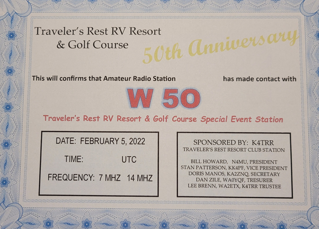
In observance of the Tampa Bay Hamfest – Saturday December 11th, 2021:
The ARRL West Central Florida Section ARES Net – HF Edition conducted on Saturday at 0730 or immediately following the Florida Phone Traffic Net on 3940 KHz, will be cancelled on Saturday December 11th,2021 and will resume normal operation for its final session for the year 2021 on Saturday December 18th, 2021.
In observance of Christmas Day – Saturday December 25th, 2021 and New Years Day – Saturday January 1st, 2022:
The ARRL West Central Florida Section ARES Net – VHF/UHF Edition conducted on Monday at 1930 on the NI4CE Repeater System, will be cancelled on Monday December 20th, 2021 and Monday December 27th, 2021 and will resume normal operation on Monday January 3rd, 2022.
The ARRL West Central Florida Section Technical Net conducted on Thursday at 2100 on the NI4CE Repeater System will be cancelled on Thursday December 23rd, 2021 and Thursday December 30th, 2021 and will resume normal operation on Thursday January 6th, 2022.
The ARRL West Central Florida Section ARES Net – HF Edition conducted on 3940 KHz at 0730 or immediately following the Florida Phone Traffic Net will be cancelled on Saturday December 25th, 2021 and Saturday January 1st, 2022 and will resume normal operation on Saturday January 8th, 2022.
The Eagle Net, the NTS traffic for the ARRL West Central Florida Section, which meets daily at 2030 on the NI4CE Repeater System will operate as normally scheduled. In keeping with holiday tradition, Darrell Davis KT4WX, Assistant Section Manager of the ARRL West Central Florida Section, will be Net Control for the Christmas Eve and New Year’s Eve editions of the Eagle Net. Darrell will be asking a holiday oriented question on each net. Darrell will take answers from participating stations that wish to answer the holiday related question of the evening. The answers are always very interesting to listen to.
The ARRL West Central Florida Section wishes everyone a safe and happy Thanksgiving and Christmas seasons.
END OF PRESS RELEASE