WCF SECTION SPECIAL BULLETIN #5 – 2200 EDT – 9/08/17
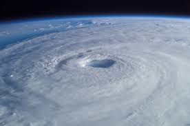
SITUATION: As of 2000 EDT, Hurricane Irma was located about 315 southeast of Miami just off of the northern coast of Cuba. Irma is currently moving west at approximately 12 miles per hour, has maximum sustained winds of 155 MPH, still making it a dangerous Category 5 hurricane. The minimum central pressure is 27.29″, which is still extremely low.
Hurricane Warnings have been in effect since this afternoon for the following West Central Florida Section Counties: Charlotte, Hardee, Highlands, Manatee, and Sarasota Counties. Hurricane Watches are in effect for the following West Central Florida Section Counties: Pasco, Pinellas, Hillsborough, and Polk Counties. A Storm Surge Watch has been issued for the following West Central Florida Section counties: Sarasota, and Charlotte Counties. Much of the Southern Florida Section is under Hurricane Warnings and the west coast counties in Southern Florida are also under a Storm Surge Watch as well. Hurricane Watches extend all the way north up through Citrus County on the west coast and Volusia County on the east coast.
The forecast track has changed some since yesterday. Irma is expected to continue its west-northwest track going around the southern periphery of the mid Atlantic ridge of high pressure. Once it reaches the southwestern side of the high, Irma is forecast to turn northwest, then north and toward Florida in response to a trough of low pressure coming out of the continental United States heading towards Florida, which will erode the mid Atlantic high pressure ridge slightly. The center of the track is forecast to now move over the eastern part of the coastal counties on the Florida west coast instead of moving up the middle of the state or up the east coast as previously forecast. However, Tropical Storm force winds will impact all of the peninsula with the exception of the panhandle. Gale force and hurricane force winds could still impact the west side of the state of Florida as Irma moves northward.
Hurricane Irma Forecast Discussion: http://www.nhc.noaa.gov/text/refresh/MIATCDAT1+shtml/061448.shtml
Hurricane Irma Graphical Forecast Track: http://www.nhc.noaa.gov/refresh/graphics_at1+shtml/145453.shtml?cone#contents
ACTIONS: At this time, also all West Central Florida Section counties either have already open shelters or will open shelters on Saturday morning in advance of Hurricane Irma. Therefore in support of these activations or planned activations, West Central Florida Section ARES will now go from a Level 2 to a Level 1 activation to provide any needed support for these activations. either current or planned. All ARES, ACS, and CERT personnel are requested to continue to closely monitor the National Hurricane Center latest advisories on Hurricane Irma and to be in communications with their respective leadership in case their assistance with communications support is needed. All amateur radio operators should be bringing to completion any preparedness actions by Saturday morning.
The Section Manager and the Section Emergency Coordinator will conduct another special session of the West Central Florida Section ARES Net tomorrow evening at 1930 hours on the NI4CE Repeater System to assess any unmet needs of any ARES or ACS groups operating in our ten counties and collecting reports from these ten counties. If necessary, another special session of the WCF Section ARES Net will be held on the NI4CE Repeater System. The State of Florida SARNet is currently running a coordination and assistance net to help communicate between the county EOC’s and the State EOC and to provide assistance to amateur radio operators in other ways, time permitting.
The next WCF SECTION SPECIAL BULLETIN for Hurricane Irma will be issued tomorrow at 1100 EDT, or sooner if conditions warrant.