WCF SECTION SPECIAL BULLETIN #6 – 1200 – 9/01/16

TROPICAL STORM HERMINE HEADED FOR THE PANHANDLE NEAR TALLAHASSEE – WCF SECTION PREPAREDNESS.
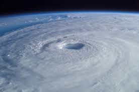
At 1100, Tropical Storm Hermine, formerly Tropical Depression #9, was located approximately 220 west of Tampa or 170 west-southwest of Apalachicola. Tropical Storm Hermine, is currently headed north-northeast at 14 MPH and is expect to make landfall in Wakulla County late Thursday evening or early Friday morning. Tropical Storm Hermine is expected to become a minimal hurricane just before landfall. If it does become a hurricane, it will be the first hurricane to make landfall in Florida since Hurricane Wilma in October 2005.
A Hurricane Warning has been issued for Wakulla County, just south of Tallahassee. A Hurricane Watch is still in effect for the coastal region of Pasco County in the West Central Florida Section and the coastal counties north of Pasco County all the way to Bay County in the Panhandle. A Tropical Storm Warning is still in effect for all of Pasco County in the West Central Florida Section and all of the coastal counties north of Pasco County all the way to Bay County in the Panhandle. Also at this time there are Flood Warnings in effect for portions of the Peace River, Anclote River, and the Myakka River and other flood prone areas. Heavy Rain in the Tampa Bay Area and northward can still be expected but some heavy rain is still possible across much of the West Central Florida Section, although the chances outside of the Tampa Bay Area may be somewhat diminished.
At this time Pinellas County ARES/ACS, Hillsborough County ARES/RACES, and Sarasota County ACS have been requested by their served agencies to partially active, due to the Flooding potential in their areas. Other county ARES groups are on standby in case they are requested to activate. All ARES members in the West Central Florida Section are encouraged to continue to monitor the latest National Hurricane Center advisories, check their own supplies and equipment, and check with their local ARES Emergency Coordinator to see if their group has been requested to activate by their served agencies.
Also the Hurricane Watch Net was activated at 1000 this morning in support of Tropical Storm Hermine. The Hurricane Watch Net is operating on 14.325 MHz on 20 Meters, mainly during the day, and on 7.268 MHz on 40 Meters, during the night. Unless you are involved in submitting real weather data from the areas affected by Hermine, please avoid these frequencies while the Hurricane Watch Net is in session. For more information on the Hurricane Watch Net go to http://www.hwn.org.
The next special bulletin will be issued at 1200 tomorrow unless conditions warrant a special bulletin to be issued sooner.