WCF SECTION SPECIAL BULLETIN #1 – 1900 EDT – 6/05/16

TROPICAL STORM COLIN FORMS – WCF SECTION PREPAREDNESS
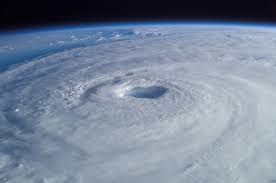
On Sunday morning at 0800 EDT, Tropical Depression #3 forms near the Yucatan peninsula, then is upgraded to Tropical Storm Colin at 1630 EDT Sunday afternoon. Tropical Storm Colin was located as of the 1700 EDT advisory about 465 miles southeast of Tampa, FL. The storm is moving north and is currently expected to turn northeast before making landfall in the big bend area of the Florida panhandle sometime tomorrow afternoon. Tropical Storm Warning are currently in effect for Hillsborough, Pinellas, and Pasco Counties and for the gulf waters from Sarasota County through Pasco County. An Area Flood Watch will be in effect on Monday 6/06 from 0400 through 2400.
All ARES personnel should stay in contact with their local ARRL Emergency Coordinator in their county in case of any potential activation. All SKYWARN certified amateur radio operators should monitor their local SKYWARN net frequencies in case of any SKYWARN nets due to severe weather. All amateur radio operators in the West Central Florida Section are asked to monitor the latest advisories issued by the National Hurricane Center, any Hurricane Local Statements or any other related watches or warnings issued by the National Weather Service office in Ruskin, which covers all counties in the West Central Florida Section.
The website for the National Hurricane Center is http://www.nhc.noaa.gov and the website for the National Weather Service Office in Ruskin (Tampa Bay) is http://www.srh.noaa.gov/tbw.