HAMFEST AND CLUB MEETING CANCELLATIONS CONTINUE DUE TO COVID-19 CONCERNS
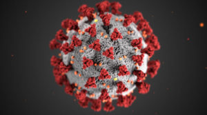
 The cancellations of hamfest, some club meetings, and amateur radio related events continue as a precautionary measure against the spread of the COVID-19 virus. The following additional hamfests, local radio club meetings, and amateur radio events have been cancelled since Thursday March 12 when WCF SECTION PRESS RELEASE #20-16 was issued: The ZAARC Hamfest 2020 scheduled for Saturday March 21st has been cancelled. The Pasco County Hamfest Spring 2020 scheduled for Saturday March 28th has been cancelled. The Highlands County Amateur Radio Club monthly club meeting scheduled for Monday March 16th has been cancelled. The Glorious Society of the Wormhole monthly club meeting scheduled for Saturday April 4th has been cancelled. The Sarasota Amateur Radio Society monthly club meeting scheduled for Tuesday March 17th has been cancelled. The Gulf Coast Amateur Radio Club monthly VE test session schedule for Wednesday April 1, has been cancelled.
The ARRL News announced on Sunday March 15, the Dayton Amateur Radio Association has cancelled the Dayton Hamvention for 2020 scheduled for May 15 through May 17. The ARRL News announced on Friday March 13th, that ARRL HQ has discontinued all public tours of ARRL HQ and W1AW until further notice.
Here in the ARRL West Central Florida Section, several county emergency management agencies have gone to some kind of partial activation in response to the COVID-19 virus. On Saturday March 7th, the State of Florida Emergency Operations Center went to a Level 2 activation to deal with the ongoing COVID-19 response. On Monday March 9th, Governor Ron Desantis issued Executive Order 2020-52 declaring a state of emergency in the State of Florida. On Friday March 13, the Florida Department of Education announced that all Florida public school districts to close from the period of Monday March 16th through Friday March 27th.
The ARRL West Central Florida Section will continue to issue WCF SECTION PRESS RELEASES as cancellations notices of hamfests and local radio club meetings and or VE test sessions come to our attention. Please continue to monitor the latest information being issued by the U.S. Centers for Disease Control and Prevention at https://www.cdc.gov/coronavirus/2019-ncov/index.html and the Florida Department of Health at http://www.floridahealth.gov/diseases-and-conditions/COVID-19/index.html.
Update: The State of Florida EOC is now at a Level 1 activation as of Sunday March 15 to deal with the COVID-19 response.
END OF PRESS RELEASE
 The WCF PRESSER Issue #48 for April 2020, has been published on the Section website. An announcement of the publication of the WCF PRESSER will be disseminated on the ARRL remailer shortly. If anyone has any information that is amateur radio related that you would like to go into the next issue of THE WCF PRESSER, please send that to our newsletter editor, Jim Weslager K3WR via email at weslager@gmail.com.


