WCF SECTION SPECIAL BULLETIN #1 – 1100 – 8/27/19
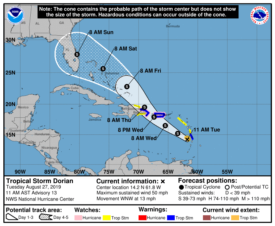
Tropical Sto rm Dorian is currently located about 60 miles west-northwest of St. Lucia in the Windward Islands. Dorian is moving towards the west-northwest at 13 miles per hour, has maximum sustained winds of 50 miles per hour, with Tropical Storm force winds out to 45 miles from the center, and the minimum central pressure is still around 29.68″ or 1005 millibars. There are Hurricane Watches and Tropical Storm Warnings in effect for Puerto Rico and some of the eastern parts of the Dominican Republic. There are Tropical Storm Watches in effect for the eastern parts of the Dominican Republic not covered by a Tropical Storm Warning and or a Hurricane Watch and much of the Leeward Islands.
The following quote is from the discussion given by the National Hurricane Center: “Dorian is moving toward the west-northwest near 13 mph (20 km/h), and this motion is expected to continue through tonight, followed by a turn toward the northwest on Wednesday. On the forecast track, the center of Dorian will move across the eastern and northeastern Caribbean Sea during the next few days, passing near or south of Puerto Rico on Wednesday, move near or over eastern Hispaniola Wednesday night, and move north of Hispaniola on Thursday. On Thursday night and Friday, the center of Dorian is forecast to move near the Turks and Caicos and southeastern Bahamas…Slow strengthening is forecast during the next 48 hours, and Dorian is forecast to be near hurricane strength when it moves close to Puerto Rico and eastern Hispaniola.”
The impacts to the West Central Florida Section are still quite variable and will be more certainly known in the next 24 to 48 hours.
At the present time we have not had any requests to activate any ARES or CERT groups from any of our county emergency management offices or any other served agencies. All ARES, ACS, and CERT groups personnel are request to continue to closely monitor the latest advisories by the National Hurricane Center in Miami. All ARES, ACS, and CERT groups should stay in communication with their respective leadership for their groups in case that group is requested to activate. All ARES, ACS, and CERT groups personnel are highly encouraged to do any final checks on your equipment and supplies in case your group is requested to activate. Also everyone is highly encourage to start and or continue any preparedness activities on your personal property.
The next WCF Section Special Bulletin will be issued following the 1100 advisory tomorrow unless conditions warrant a bulletin to be issued sooner.