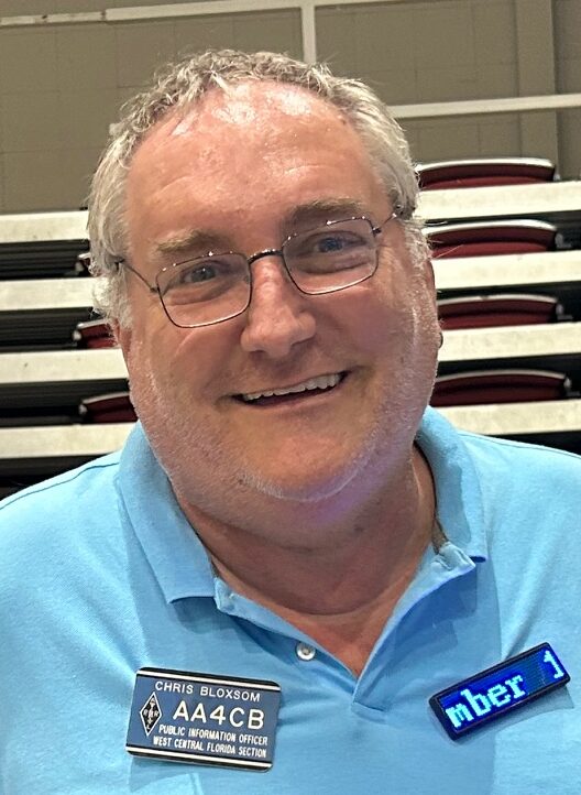
WCF SECTION PRESS RELEASE #24-15

RUSS DELANEY N4RTD IS THE 2024 ELLEN WHITE W1YL AWARD RECIPIENT

The 2024 Ellen White W1YL Award recipient is Russ Delaney N4RTD.  Delaney was first licensed in 1990 as N8MYO, following being interested in amateur radio since the mid 1970’s.  Delaney’s interests in amateur radio include building and experimenting with electronics and computers, emergency communications, and QRP operating.  Delaney has been Assistant Emergency Coordinator for Operations for Polk County ARES since March 2023 and an Assistant Section Manager of the ARRL West Central Florida Section since March of this year.  Delaney maintains in addition to a detailed page on QRZ.com, a personal website at https://delaney.rocks/ and his own YouTube channel called “Spurious Emissions” on YouTube at https://www.youtube.com/@spurious_emissions.  (In his professional career Delaney worked in management and IT for Northwest Airlines and Delta, retiring from Delta in 2020.

Darrell Davis KT4WX, Assistant Section Manager of the ARRL West Central Florida Section made the following comments about Delaney being the 2024 Ellen White W1YL Award recipient, “Russ is the definition of a amateur radio helper.  He goes ‘out of his way’ to help any amateur radio operator in need without regard to the time or distance traveled helping them, which includes having his laptop on hand to do a ‘drive by programming session’ for someone who is in need of having a radio programmed.  He is deserving of the Ellen White W1YL Award.”

The ARRL West Central Florida Section congratulates Russ Delaney N4RTD on being named the 2024 Ellen White W1YL Award recipient.  The 2024 Ellen White W1YL Award was accepted by Darrell Davis KT4WX on behalf of Delaney, who could not attend, at the ARRL forum during the Tampa Bay Hamfest on Saturday December 14, 2024.  As in the past several years, The West Central Florida Group, the owners and operators of the NI4CE Repeater System, have sponsored a one year ARRL membership for Delaney.

The Ellen White W1YL Award was established in 2016 in memory of Ellen White W1YL, who recently became a Silent Key in November of 2022.  The Ellen White W1YL Award is to name the amateur radio operator who has made the greatest contribution to amateur radio in the ARRL West Central Florida Section.

For all the details and history of the Ellen White W1YL Award you may go to http://arrlwcf.org/wcf-special-events/white-award/.

END OF PRESS RELEASE

WCF SECTION PRESS RELEASE #24-14

DATE AND VENUE FOR 11TH ANNUAL TECHCON IN 2025 SET

The date and venue for the 11th Annual TECHCON have been set.  The date for the 11th Annual TECHCON, the Annual Technical Conference for the ARRL West Central Florida Section, is Saturday February 22, 2025.  The venue for the 11th Annual TECHCON will once again be the Polk County Emergency Operations Center, located at 1890 Jim Keene Blvd., Winter Haven, FL 33880, located between Winter Haven and Lakeland just off of the Polk County Parkway.

The 11th Annual TECHCON primary track will be available for viewing on the Section YouTube channel.  The second track, that runs simultaneously will be recorded for later viewing on the Section YouTube channel.  The Section YouTube channel is located at  https://www.youtube.com/channel/UCFA4-HEjr-lYMFisVG_Nk5A.

Registration for the 11th Annual TECHCON is now open.  We are looking for presenters for TECHCON.  To have a successful TECHCON, we must have those who are willing to be presenters, especially those who have not been a presenter before.  The topic of presentation is, as always, the choice of the presenter, as long as the topic is related to amateur radio.

You may register to either attend or make a presentation for TECHCON at http://arrlwcf.org/section-forms/wcftechconfregistration/.  For more information about TECHCON you may go to the TECHCON webpage on the Section website at http://arrlwcf.org/wcf-special-events/wcftechconference/.

END OF PRESS RELEASE

WCF SECTION PRESS RELEASE #24-13

NWS RUSKIN ACTIVATING WX4TOR FOR SKYWARN RECOGNITION DAY 2024

Coming up on Saturday December 7, 2024, will be the 2024 Skywarn Recognition Day.  Skywarn Recognition Day.  Skywarn Recognition Day was started in 1999 and has been done annually ever since. For more information about Skywarn Recognition Day you may go to the NWS Ruskin Skywarn Recognition Day information page located at https://www.weather.gov/tbw/srd.

The National Weather Service Office in Ruskin will be activating WX4TOR for Skywarn Recognition Day.  WX4TOR will be monitoring the Analog and NXDN NI4CE repeater systems if you would like a quick check-in during the event.  For information on the NI4CE Repeater Systems, either Analog and or NXDN you may go to https://www.ni4ce.org.  WX4TOR will also be trying to contact as many hams as possible HF and possibly EchoLink.  The hours of operation of WX4TOR will be on Saturday December 2, 2023 from 0800 EST until 1600 EST (1300Z until 2100Z).

Local Skywarn™ spotters are welcome on Saturday December 7, 2024 from 0800 EST until 1600 EST, to visit our local Tampa Bay, Ruskin office of the National Weather Service. Stop on out and operate the radios, as well as take a tour of the office. The National Weather Service office in Ruskin is located at 2525 14th Ave. SE Ruskin, FL 33570.

END OF PRESS RELEASE

WCF SECTION PRESS RELEASE #24-12

SECTION NET CANCELLATIONS FOR THE MONTHS OF NOVEMBER AND DECEMBER 2024

In observance of Thanksgiving, the 49th Annual Tampa Bay Hamfest, Christmas, and New Years holidays, and in keeping with tradition, the following Section nets will be cancelled during the months of November and December 2024:

For the month of November the following Section nets will be cancelled:

  • The ARRL West Central Florida Section ARES and Information Net on the NI4CE Repeater System scheduled for 1930 EST on Monday November 25, 2024 will be cancelled.  This net will resume normal operation on Monday December 2, 2024.
  • The ARRL West Central Florida Section Technical Net on the NI4CE Repeater System scheduled for 2100 EST on Thursday November 28, 2024 will be cancelled.  This net will resume normal operation on Thursday December 5, 2024.
  • The ARRL West Central Florida Section ARES and Information Net on 3940 KHz scheduled for 0730 EST on Saturday November 30, 2024 will be cancelled.    This net will resume normal operation for the last session of 2024 on Saturday December 7, 2024.

For the month of December, the following Section Nets will be cancelled:

  • The ARRL West Central Florida Section ARES and Information Net on 3940 KHz scheduled for 0730 EST on Saturday December 14, 2024 will be cancelled due to the operation of the Tampa Bay Hamfest.  The net will resume normal operation on Saturday January 4, 2025.
  • The ARRL West Central Florida Section ARES and Information Net on the NI4CE Repeater System scheduled for 1930 EST on Monday December 23, 2024 and Monday December 30, 2024 will be cancelled.  This net will resume normal operation on Monday January 6, 2025.
  • The ARRL West Central Florida Section Technical Net on the NI4CE Repeater System scheduled for 2100 EST on Thursday December 19, 2024 and Thursday December 26, 2024 will be cancelled.  This net will resume normal operation on Thursday January 2, 2025.
  • The ARRL West Central Florida Section ARES and Information Net on 3940 KHz scheduled for 0730 EST on Saturday December 21, 2024 and Saturday December 28, 2024 will be cancelled.  This net will resume normal operation on Saturday January 4, 2025.

The Eagle Net, the NTS traffic for the ARRL West Central Florida Section, on the NI4CE Repeater System scheduled for 2030 EST daily, will operate as scheduled throughout the holidays, as it is an NTS traffic net.  In keeping with tradition, Darrell Davis KT4WX, will be net control of the Eagle Net for the Christmas Eve and New Years Eve editions of the Eagle Net.  Look for the details of these special nets in an upcoming WCF SECTION PRESS RELEASE.

The ARRL West Central Florida Section wishes everyone a Happy Thanksgiving, Merry Christmas and a Happy New Year season.

END OF PRESS RELEASE

WCF SECTION PRESS RELEASE #24-11

NOMINATIONS FOR THE 2024 ELLEN WHITE W1YL AWARD ARE NOW OPEN


Nominations for the 2024 Ellen White W1YL Award for are now open.  Nominations for the 2024 Ellen White W1YL Award may be made via the Section website Contact and Information Form at http://arrlwcf.org/section-forms/contact-info/.  The Ellen White W1YL Award is given by the ARRL West Central Florida Section each year to honor the amateur radio operator who has made the greatest contribution to amateur radio in the ARRL West Central Florida Section for the current calendar year.  Nominations for the 2024 Ellen White W1YL award will close on Saturday November 30, 2024.  The recipient of the award will be announced on Friday December 13, 2024 at the Tampa Bay Hamfest and the award will be presented to that recipient during the ARRL forum at the Tampa Bay Hamfest on Saturday December 14, 2024.

The namesake of the award, Ellen White W1YL, became a Silent Key on Saturday November 5, 2022.  White was appointed by Darrell Davis KT4WX in 2016, Section Manager of the ARRL West Central Florida section at the time, due to her contributions to amateur radio over many years, which included being in amateur radio for 75 years and working at ARRL HQ for 25 years.

For details on the Ellen White W1YL Award, you may go to the Section website Ellen White W1YL Award page at http://arrlwcf.org/wcf-special-events/ellen-white-w1yl-award/.  For a detailed article on the life of Ellen White W1YL, please go to the ARRL News article published on November 7, 2022 at http://www.arrl.org/news/ellen-white-w1yl-silent-key-devoted-lifetime-to-amateur-radio-and-arrl.

END OF PRESS RELEASE

WCF SECTION SPECIAL BULLETIN #24-14 – 1200 EDT – 10/10/24 – FINAL

HURRICANE MILTON – 1200 EDT – 10/10/24

Hurricane Milton made landfall at Siesta Key yesterday evening around 2030 EDT, moved through eastern Manatee, northwestern Hardee County, southern Polk County, northern Osceola and exited the east coast at Cape Canaveral in Brevard County around 0600 EDT this morning.  Milton was beginning the process of transitioning into an extra-tropical area of low pressure as it was exiting the east coast of Florida.  So we say to Milton, “bye bye and you are not welcome to come back ever again.”

COASTAL WATCHES/WARNINGS AND FORECAST CONE FOR STORM CENTER

SUMMARY OF 1700 EST…2100 UTC…INFORMATION

——————————————————————————-
LOCATION…29.1N 78.5W
ABOUT 135 MI…220 KM ENE OF CAPE CANAVERAL FLORIDA
ABOUT 205 MI…330 KM NNW OF GREAT ABACO ISLAND
MAXIMUM SUSTAINED WINDS…80 MPH…130 KM/H
PRESENT MOVEMENT…ENE OR 65 DEGREES AT 20 MPH…31 KM/H
MINIMUM CENTRAL PRESSURE…983 MB…29.03 INCHES

SUMMARY OF WATCHES AND WARNINGS IN EFFECT:

SUMMARY OF WATCHES AND WARNINGS IN EFFECT:
A Storm Surge Warning is in effect for…
* Sebastian Inlet Florida to Altamaha Sound Georgia, including the St. Johns River

A Tropical Storm Warning is in effect for…
* Sebastian Inlet Florida northward to Edisto Beach South Carolina
* Extreme northwestern Bahamas, including Grand Bahama Island and the Abacos

A Storm Surge Warning means there is a danger of life-threatening inundation, from rising water moving inland from the coastline in the indicated locations. For a depiction of areas at risk, please see the National Weather Service Storm Surge Watch/Warning Graphic,
available at hurricanes.gov.

A Tropical Storm Warning means that tropical storm conditions are expected somewhere within the warning area.

For storm information specific to your area in the United States, including possible inland watches and warnings, please monitor products issued by your local National Weather Service forecast office. For storm information specific to your area outside of the United States, please monitor products issued by your national meteorological service.

FORECAST DISCUSSION:

Milton is quickly taking on extratropical characteristics, with convection more closely aligned along a warm frontal boundary to the northeast than the center itself. Due to the structure evolution, it is likely that the strongest winds are located to the northwest of the center. The intensity is lowered to 70 kt, based on continuity from the previous forecast. Scatterometer passes are expected in a few hours and should allow us to get a better handle on Milton’s intensity and structure.

The hurricane has turned east-northeastward (065/17 kt). Milton is located within the base of a deep-layer trough located over the western Atlantic, and this feature should steer the storm eastward later today, with that motion continuing for the next 3 days. The NHC forecast is a little faster than the previous prediction to follow the recent trends in the model guidance.

Global model fields show low-level thickness contours packing closer together on the northwest side through the day, and it is therefore likely that Milton will complete extratropical transition by this afternoon or evening. Milton will still be a powerful
post-tropical cyclone, but its maximum winds are expected to gradually decrease during the next few days. The post-tropical low is expected to become diffuse and will likely dissipate in about 4 days.

SITUATION AND ACTIONS:

All Hurricane Warnings, Tropical Storm Warnings, and Storm Surge Warnings have been discontinued earlier today.  The only warnings still in effect are localized Flood Warnings for various rivers in the ARRL West Central Florida Section.

As of 1200 EDT, there are slightly over 3.4 million customers in the State of Florida without electrical power at this time.  Out of this number 1.9 million customers in the ARRL West Central Florida Section are without electrical power.  That is 55 percent of the total customers without power in the State of Florida

The Section ARES Alert Level is currently still at a Level 1.  All ARES Groups that are tasked with doing response are still deployed, but some will be expecting to demobilize soon.  The latest status can be found on the main page of the Section website under the “ARRL West Central Florida Section ARES Alert Status.

All ARES, ACS, and CERT personnel are encouraged to continue to check the Tropical Weather Outlook issued four times daily by the National Hurricane Center.  Currently there are two other tropical storms out in the Atlantic, which do not threaten the continental United States.  However, this can change rapidly, so vigilance is the order of hurricane season.

LATEST NATIONAL HURRICANE CENTER INFORMATION:

Public Advisories:   https://www.nhc.noaa.gov/text/refresh/MIATCPAT4+shtml/062052.shtml?

Forecast Advisory:  https://www.nhc.noaa.gov/text/refresh/MIATCMAT4+shtml/062051.shtml?

Forecast Discussion: https://www.nhc.noaa.gov/text/refresh/MIATCDAT4+shtml/062053.shtml?

Latest GOES Satellite Floater Images and Loop:  https://www.star.nesdis.noaa.gov/GOES/floater.php?stormid=AL142024#navLink

CONCLUSION

This will be the final bulletin for Hurricane Milton.

END OF SPECIAL BULLETIN

WCF SECTION SPECIAL BULLETIN #24-13 – 1800 EDT – 10/09/24

HURRICANE MILTON – 1800 EDT – 10/09/24

Hurricane Milton is now moving at 17 MPH in forward speed and has weakened to a Category 3 hurricane with maximum sustained winds of 120 MPH.  The center of Milton is now 60 miles southwest of Sarasota and is expected to make landfall near Bradenton later this evening.  An approaching front with its preceding trough will continue to determine the final path of Milton and is now wrapped around the north and west side of Milton.   Milton is expected to cross the Florida peninsula in the overnight hours and expected to exit the east coast tomorrow morning by way of Brevard County.  Even with the weakening of Milton, it is still a dangerous storm and not to be taken for granted.  We have a long night ahead of us in many respects.

COASTAL WATCHES/WARNINGS AND FORECAST CONE FOR STORM CENTER

SUMMARY OF 1700 EST…2100 UTC…INFORMATION

——————————————————————————-
LOCATION…26.9N 83.4W
ABOUT 60 MI…100 KM WSW OF SARASOTA FLORIDA
ABOUT 170 MI…275 KM SW OF ORLANDO FLORIDA
MAXIMUM SUSTAINED WINDS…120 MPH…195 KM/H
PRESENT MOVEMENT…NE OR 35 DEGREES AT 17 MPH…28 KM/H
MINIMUM CENTRAL PRESSURE…948 MB…28.00 INCHES

SUMMARY OF WATCHES AND WARNINGS IN EFFECT:

SUMMARY OF WATCHES AND WARNINGS IN EFFECT:
A Storm Surge Warning is in effect for…
* Florida west coast from Flamingo northward to Yankeetown, including Charlotte Harbor and Tampa Bay
* Sebastian Inlet Florida to Altamaha Sound Georgia, including the St. Johns River

A Hurricane Warning is in effect for…
* Florida west coast from Bonita Beach northward to Suwannee River, including Tampa Bay
* Florida east coast from the St. Lucie/Martin County Line northward to Ponte Vedra Beach

A Hurricane Watch is in effect for…
* Lake Okeechobee
* Florida east coast from the St. Lucie/Martin County Line to the Palm Beach/Martin County Line

A Tropical Storm Warning is in effect for…
* Florida Keys, including Dry Tortugas and Florida Bay
* Lake Okeechobee
* Florida west coast from Flamingo to south of Bonita Beach
* Florida west coast from north of Suwanee River to Indian Pass
* Florida east coast south of the St. Lucie/Martin County Line to Flamingo
* North of Ponte Vedra Beach Florida to Edisto Beach South Carolina
* Extreme northwestern Bahamas, including Grand Bahama Island, the Abacos, and Bimini

A Storm Surge Warning means there is a danger of life-threatening inundation, from rising water moving inland from the coastline, during the next 36 hours in the indicated locations. For a depiction of areas at risk, please see the National Weather
Service Storm Surge Watch/Warning Graphic, available at hurricanes.gov. This is a life-threatening situation. Persons located within these areas should take all necessary actions to protect life and property from rising water and the potential for other dangerous conditions. Promptly follow evacuation and other instructions from local officials.

A Hurricane Warning means that hurricane conditions are expected somewhere within the warning area.

A Tropical Storm Warning means that tropical storm conditions are expected somewhere within the warning area within 36 hours.

A Hurricane Watch means that hurricane conditions are possible within the watch area.

For storm information specific to your area in the United States, including possible inland watches and warnings, please monitor products issued by your local National Weather Service forecast office. For storm information specific to your area outside of the United States, please monitor products issued by your national meteorological service.

FORECAST DISCUSSION:

The Air Force Reserve Hurricane Hunters found that Milton’s central pressure had fallen to 923 mb in the last pass they made through the eye a few hours ago. The satellite presentation has improved since that time, with a thick ring of cold cloud tops surrounding a 10-mile-wide eye. This pattern yielded a T7.0/140 kt from TAFB, with several of the objective satellite estimates between 140 and 145 kt. Milton has again become a category 5 hurricane, with maximum winds estimated to be 145 kt. Another Air Force mission is
entering Milton as we speak.

Milton wobbled a bit to the southeast today, but the longer-term 12-hour motion is east-northeastward (075/8 kt). Milton is forecast to turn northeastward and begin accelerating later today as it moves between a trough digging into the Gulf of Mexico and a ridge near the Greater Antilles. Because of the wobble, the track guidance has been initialized a bit to the south of where many of the raw model fields think the hurricane was centered at 1800 UTC, and this has caused the entire guidance envelope to shift a bit south on this cycle. It is still critical to remember that even at 36 hours (around the time of potential landfall), NHC’s track forecasts can be off by an average of 60 n mi, which means we still can’t pinpoint an exact landfall location, especially if additional wobbles occur in the short term. After landfall, Milton is forecast to cross Florida and emerge over the Atlantic waters on
Thursday.

Milton is expected to maintain major hurricane strength while it moves across the Gulf of Mexico and approaches the west coast of Florida. Stronger vertical shear is expected to increase in about 24 hours, but even if this causes some weakening, it will likely not be enough to keep Milton from being an extremely dangerous hurricane when it reaches shore. Additionally, the first stages of extratropical transition may be just underway as Milton is reaching the coast, which could impart some baroclinic energy and slow the rate of weakening. The NHC intensity forecast is close to the top end of the model envelope, which includes the GFS and ECMWF models, since these models should have a better handle on a potential positive trough interaction.

Milton’s wind field is expected to expand as it approaches Florida.  In fact, the official forecast shows the hurricane and tropical-storm-force winds roughly doubling in size by the time it makes landfall. In addition, the stronger-than-normal winds could occur on the northwest/back side of the storm since Milton will be interacting with a frontal boundary and beginning extratropical transition. Damaging winds, life-threatening storm surge, and heavy rainfall will extend well outside the forecast cone. This is a very serious situation and residents in Florida should closely follow orders from their local emergency management officials. Evacuations and other preparations should be completed today.
Milton has the potential to be one of the most destructive hurricanes on record for west-central Florida.

SITUATION AND ACTIONS:

The ARRL West Central Florida Section now has the following watches and warnings in effect:

  • Hurricane Warning until further notice:  Charlotte, Desoto, Hardee, Highlands, Hillsborough, Pasco, Pinellas, Polk, and Sarasota Counties.
  • Storm Surge Warning until further notice: Coastal Pasco, Pinellas, Coastal Hillsborough, Coastal Manatee, Coastal Sarasota, and Coastal Charlotte Counties.
  • Flood Watch through Thursday morning.
  • Tornado Watch remains in effect until 2100 EDT for Pasco, Pinellas, Hillsborough, Manatee, and Sarasota Counties.  The other counties in the ARRL West Central Florida Section were in the Tornado Watch but were allowed to expire.
  • Numerous Flood Warnings have been in effect, mostly for various river and areas near these rivers since earlier in the day.

The Section ARES Alert Level is currently at a Level 1.  All ARES Groups that are tasked with doing response have been deployed.  The latest status can be found on the main page of the Section website under the “ARRL West Central Florida Section ARES Alert Status.

A Regional SKWYARN Net is now in progress on the NI4CE Analog and NI4CE NXDN Systems (talkgroup 1299), and has been since approximately 1200 EDT today.

All ARES, ACS, and CERT personnel should have completed all personal preparations and should be shelted in secure locations at this time.

All ARES, ACS, and CERT personnel are encouraged to continue to check the Tropical Weather Outlook issued four times daily by the National Hurricane Center.  Currently there are two other tropical storms out in the Atlantic, which do not threaten the continental United States.  However, this can change rapidly, so vigilance is the order of hurricane season.

LATEST NATIONAL HURRICANE CENTER INFORMATION:

Public Advisories:   https://www.nhc.noaa.gov/text/refresh/MIATCPAT4+shtml/062052.shtml?

Forecast Advisory:  https://www.nhc.noaa.gov/text/refresh/MIATCMAT4+shtml/062051.shtml?

Forecast Discussion: https://www.nhc.noaa.gov/text/refresh/MIATCDAT4+shtml/062053.shtml?

Latest GOES Satellite Floater Images and Loop:  https://www.star.nesdis.noaa.gov/GOES/floater.php?stormid=AL142024#navLink

CONCLUSION

The next WCF SECTION SPECIAL BULLETIN will be issued around 2000 EDT tomorrow evening or sooner if conditions warrant.

END OF SPECIAL BULLETIN

WCF SECTION PRESS RELEASE #24-10

EAGLE NET AND WCF SECTION TECHNICAL NET CANCELLATIONS FOR HURRICANE MILTON

Due to the soon arrival of Hurricane Milton to the west coast of Florida, the following nets will be cancelled in order to facilitate a Regional SKYWARN Net or any support needed for ARES groups that are active:

  • Eagle Net:  Cancelled until further notice when the threat from Milton is .
  • WCF Section Technical Net:  The session scheduled Thursday 10/10/24 is canceled.

Both of these nets will resume operations as soon as the current emergency situation is concluded.

END OF PRESS RELEASE

WCF SECTION SPECIAL BULLETIN #24-12 – 2000 EDT – 10/08/24

HURRICANE MILTON – 2000 EDT – 10/08/24

Hurricane Milton has remained between a Category 4 and a Category 5 hurricane.  Milton is in the process of beginning the turn towards the northeast and head for the Florida west coast.  An approaching front with its preceding trough will determine the final path of Milton.  That cold front and trough will increase the wind shear across Milton and some drier air will get drawn into Milton, lowering its intensity somewhat before landfall on the Florida west coastal, which for right now is near Sarasota, south of where the landfall was previously expected.  In spite of this change in expected landfall, Milton is still a dangerous storm and not to be taken for granted.

COASTAL WATCHES/WARNINGS AND FORECAST CONE FOR STORM CENTER

SUMMARY OF 2000 EST…0000 UTC…INFORMATION

——————————————————————————-
LOCATION…23.0N 86.9W
ABOUT 280 MI…450 KM WSW OF THE DRY TORTUGAS
ABOUT 440 MI…710 KM SW OF TAMPA FLORIDA
MAXIMUM SUSTAINED WINDS…165 MPH…270 KM/H
PRESENT MOVEMENT…ENE OR 70 DEGREES AT 10 MPH…17 KM/H
MINIMUM CENTRAL PRESSURE…902 MB…26.64 INCHES

SUMMARY OF WATCHES AND WARNINGS IN EFFECT:

SUMMARY OF WATCHES AND WARNINGS IN EFFECT:
A Storm Surge Warning is in effect for…
* Florida west coast from Flamingo northward to Suwannee River, including Charlotte Harbor and Tampa Bay
* Sebastian Inlet Florida to Altamaha Sound Georgia, including the St. Johns River

A Hurricane Warning is in effect for…
* Florida west coast from Bonita Beach northward to Suwannee River, including Tampa Bay
* Florida east coast from the St. Lucie/Martin County Line northward to Ponte Vedra Beach

A Storm Surge Watch is in effect for…
* North of Altamaha Sound Georgia to Edisto Beach South Carolina

A Hurricane Watch is in effect for…
* Dry Tortugas
* Lake Okeechobee
* Florida west coast from Chokoloskee to south of Bonita Beach
* Florida east coast north of Ponte Vedra Beach to the mouth of the St. Marys River
* Florida east coast from the St. Lucie/Martin County Line to the Palm Beach/Martin County Line

A Tropical Storm Warning is in effect for…
* Dzilam to Cancun Mexico
* Florida Keys, including Dry Tortugas and Florida Bay
* Lake Okeechobee
* Florida west coast from Flamingo to south of Bonita Beach
* Florida west coast from north of Suwanee River to Indian Pass
* Florida east coast south of the St. Lucie/Martin County Line to Flamingo
* North of Ponte Vedra Beach Florida to Altamaha Sound Georgia
* Extreme northwestern Bahamas, including Grand Bahama Island, the Abacos, and Bimini

A Tropical Storm Watch is in effect for…
* North of Altamaha Sound Georgia to South Santee River South Carolina

A Storm Surge Warning means there is a danger of life-threatening inundation, from rising water moving inland from the coastline, during the next 36 hours in the indicated locations. For a depiction of areas at risk, please see the National Weather Service Storm Surge Watch/Warning Graphic, available at hurricanes.gov. This is a life-threatening situation. Persons located within these areas should take all necessary actions to protect life and property from rising water and the potential for other dangerous conditions. Promptly follow evacuation and other instructions from local officials.

A Hurricane Warning means that hurricane conditions are expected somewhere within the warning area. A warning is typically issued 36 hours before the anticipated first occurrence of tropical-storm-force winds, conditions that make outside preparations difficult or dangerous. Preparations to protect life and property should be rushed to completion.

A Tropical Storm Warning means that tropical storm conditions are expected somewhere within the warning area within 36 hours.

A Storm Surge Watch means there is a possibility of life- threatening inundation, from rising water moving inland from the coastline, in the indicated locations during the next 48 hours.  For a depiction of areas at risk, please see the National Weather Service Storm Surge Watch/Warning Graphic, available at hurricanes.gov.

A Hurricane Watch means that hurricane conditions are possible within the watch area. A watch is typically issued 48 hours before the anticipated first occurrence of tropical-storm-force winds, conditions that make outside preparations difficult or dangerous.

A Tropical Storm Watch means that tropical storm conditions are possible within the watch area, generally within 48 hours.

For storm information specific to your area in the United States, including possible inland watches and warnings, please monitor products issued by your local National Weather Service forecast office. For storm information specific to your area outside of the United States, please monitor products issued by your national meteorological service.

FORECAST DISCUSSION:

The Air Force Reserve Hurricane Hunters found that Milton’s central pressure had fallen to 923 mb in the last pass they made through the eye a few hours ago. The satellite presentation has improved since that time, with a thick ring of cold cloud tops surrounding a 10-mile-wide eye. This pattern yielded a T7.0/140 kt from TAFB, with several of the objective satellite estimates between 140 and 145 kt. Milton has again become a category 5 hurricane, with maximum winds estimated to be 145 kt. Another Air Force mission is
entering Milton as we speak.

Milton wobbled a bit to the southeast today, but the longer-term 12-hour motion is east-northeastward (075/8 kt). Milton is forecast to turn northeastward and begin accelerating later today as it moves between a trough digging into the Gulf of Mexico and a ridge near
the Greater Antilles. Because of the wobble, the track guidance has been initialized a bit to the south of where many of the raw model fields think the hurricane was centered at 1800 UTC, and this has caused the entire guidance envelope to shift a bit south on this cycle. It is still critical to remember that even at 36 hours (around the time of potential landfall), NHC’s track forecasts can be off by an average of 60 n mi, which means we still can’t
pinpoint an exact landfall location, especially if additional wobbles occur in the short term. After landfall, Milton is forecast to cross Florida and emerge over the Atlantic waters on
Thursday.

Milton is expected to maintain major hurricane strength while it moves across the Gulf of Mexico and approaches the west coast of Florida. Stronger vertical shear is expected to increase in about 24 hours, but even if this causes some weakening, it will likely not
be enough to keep Milton from being an extremely dangerous hurricane when it reaches shore. Additionally, the first stages of extratropical transition may be just underway as Milton is reaching the coast, which could impart some baroclinic energy and slow the
rate of weakening. The NHC intensity forecast is close to the top end of the model envelope, which includes the GFS and ECMWF models, since these models should have a better handle on a potential positive trough interaction.

Milton’s wind field is expected to expand as it approaches Florida.  In fact, the official forecast shows the hurricane and tropical-storm-force winds roughly doubling in size by the time it makes landfall. In addition, the stronger-than-normal winds could occur on the northwest/back side of the storm since Milton will be interacting with a frontal boundary and beginning extratropical transition. Damaging winds, life-threatening storm surge, and heavy rainfall will extend well outside the forecast cone. This is a very serious situation and residents in Florida should closely follow orders from their local emergency management officials. Evacuations and other preparations should be completed today.
Milton has the potential to be one of the most destructive hurricanes on record for west-central Florida.

SITUATION AND ACTIONS:

The ARRL West Central Florida Section now has the following watches and warnings in effect:

  • Hurricane Warning until further notice:  Charlotte, Desoto, Hardee, Highlands, Hillsborough, Pasco, Pinellas, Polk, and Sarasota Counties.
  • Storm Surge Warning until further notice: Coastal Pasco, Pinellas, Coastal Hillsborough, Coastal Manatee, Coastal Sarasota, and Coastal Charlotte Counties.
  • Flood Watch through Thursday morning.

As of press time, we have the following information on ARES groups activations.  The following ARES groups have been activated:  Charlotte County ARES, Hillsborough County ARES/RACES, Pinellas County ARES/ACS, Manatee County ARES, and Desoto County ARES.  The following ARES groups are to active on Wednesday morning 10/09/24:  Hardee County ARES, Highlands County ARES, and Polk County ARES.

The Section ARES Alert Level is currently at a Level 2.  Then when all ARES groups available activate, the ARES Alert Level will go to a Leve1 alert, which is a full activation.  This is subject to change on a moments notice.  The latest status can be found on the main page of the Section website under the “ARRL West Central Florida Section ARES Alert Status.

A Regional SKWYARN Net will be held on the NI4CE Analog and NI4CE NXDN Systems (talkgroup 1299) once the landfall of Milton gets closer.

All ARES, ACS, and CERT personnel are encouraged to rush to completion any personal preparations that have not been completed.

All ARES, ACS, and CERT personnel are encouraged to continue to check the Tropical Weather Outlook issued four times daily by the National Hurricane Center.  Currently there are two other tropical storms out in the Atlantic, which do not threaten the continental United States.  However, this can change rapidly, so vigilance is the order of hurricane season.

LATEST NATIONAL HURRICANE CENTER INFORMATION:

Public Advisories:   https://www.nhc.noaa.gov/text/refresh/MIATCPAT4+shtml/062052.shtml?

Forecast Advisory:  https://www.nhc.noaa.gov/text/refresh/MIATCMAT4+shtml/062051.shtml?

Forecast Discussion: https://www.nhc.noaa.gov/text/refresh/MIATCDAT4+shtml/062053.shtml?

Latest GOES Satellite Floater Images and Loop:  https://www.star.nesdis.noaa.gov/GOES/floater.php?stormid=AL142024#navLink

CONCLUSION

The next WCF SECTION SPECIAL BULLETIN will be issued around 2000 EDT tomorrow evening or sooner if conditions warrant.

END OF SPECIAL BULLETIN

WCF SECTION SPECIAL BULLETIN #24-11 – 2000 EDT – 10/07/24

HURRICANE MILTON – 2000 EDT – 10/07/24

Hurricane Milton has gone from a Category 1 to a Category 5 hurricane since our last special bulletin yesterday.  What is unprecedented is that the maximum sustained winds of 180 MPH and a barometric pressure of 26.97 inches!!  Milton will eventually turn towards the northeast and head for the Florida west coast, as an approaching front with its preceding trough will determine the final path of Milton.  That cold front and trough will increase the wind shear across Milton and some drier air will get drawn into Milton, lowering its intensity somewhat before landfall on the Florida west coastal, which for right now is in the Tampa area.  In spite of this, Milton is still a dangerous storm and not to be taken for granted.

COASTAL WATCHES/WARNINGS AND FORECAST CONE FOR STORM CENTER

SUMMARY OF 2000 EST…0000 UTC…INFORMATION

——————————————————————————-
LOCATION…21.9N 90.4W
ABOUT 60 MI…100 KM NW OF PROGRESO MEXICO
ABOUT 650 MI…1045 KM SW OF TAMPA FLORIDA
MAXIMUM SUSTAINED WINDS…180 MPH…285 KM/H
PRESENT MOVEMENT…E OR 90 DEGREES AT 10 MPH…17 KM/H
MINIMUM CENTRAL PRESSURE…897 MB…26.49 INCHES

SUMMARY OF WATCHES AND WARNINGS IN EFFECT:

SUMMARY OF WATCHES AND WARNINGS IN EFFECT:
A Storm Surge Warning is in effect for…
* West coast of Florida from Flamingo northward to the Suwannee River, including Charlotte Harbor and Tampa Bay

A Hurricane Warning is in effect for…
* Celestun to Rio Lagartos
* Florida west coast from Bonita Beach northward to the mouth of the Suwannee River, including Tampa Bay

A Storm Surge Watch is in effect for…
* Sebastian Inlet to Edisto Beach, including St. Johns River

A Hurricane Watch is in effect for…
* Rio Lagartos to Cabo Catoche
* Campeche to south of Celestun
* Dry Tortugas
* Lake Okeechobee
* Florida west coast from Chokoloskee to south of Bonita Beach
* Florida east coast from the St. Lucie/Indian River County Line
northward to the mouth of the St. Marys River

A Tropical Storm Warning is in effect for…
* Rio Lagartos to Cancun
* Campeche to south of Celestun
* All of the Florida Keys, including Dry Tortugas
* Lake Okeechobee
* Florida west coast from Flamingo to south of Bonita Beach
* Florida west coast from north of the mouth of the Suwanee River to Indian Pass

A Tropical Storm Watch is in effect for…
* East coast of the Florida Peninsula south of the St. Lucie/Indian River County Line southward to Flamingo
* Coast of Georgia and South Carolina from north of the mouth of the St. Marys River to South Santee River, South Carolina

A Storm Surge Warning means there is a danger of life-threatening inundation, from rising water moving inland from the coastline, during the next 36 hours in the indicated locations. For a depiction of areas at risk, please see the National Weather Service Storm Surge Watch/Warning Graphic, available at hurricanes.gov. This is a life-threatening situation. Persons located within these areas should take all necessary actions to protect life and property from rising water and the potential for other dangerous conditions. Promptly follow evacuation and other instructions from local officials.

A Hurricane Warning means that hurricane conditions are expected somewhere within the warning area. A warning is typically issued 36 hours before the anticipated first occurrence of tropical-storm-force winds, conditions that make outside preparations difficult or dangerous. Preparations to protect life and property should be rushed to completion.

A Tropical Storm Warning means that tropical storm conditions are expected somewhere within the warning area within 36 hours.

A Storm Surge Watch means there is a possibility of life-threatening inundation, from rising water moving inland from the coastline, in the indicated locations during the next 48 hours. For a depiction of areas at risk, please see the National Weather Service Storm Surge Watch/Warning Graphic, available at hurricanes.gov.

A Hurricane Watch means that hurricane conditions are possible within the watch area. A watch is typically issued 48 hours before the anticipated first occurrence of tropical-storm-force winds, conditions that make outside preparations difficult or dangerous.

A Tropical Storm Watch means that tropical storm conditions are possible within the watch area, generally within 48 hours.

Interests in the remainder of Florida and the northwestern Bahamas should monitor the progress of this system.

FORECAST DISCUSSION:

The following excerpt is from the Forecast Discussion issued at 1700 EDT today:

Milton is rapidly intensifying. Satellite images indicate very deep convection in the eyewall and hints of an eye starting to appear. The last fix from the aircraft showed that the central pressure was down to 985 mb, about 3 mb less than 80 minutes prior, and winds supporting 70 kt at the surface. Since that time, satellite images continue to show further organization, and the initial wind speed is set to 75 kt.

Milton is moving just south of due east at about 6 kt. This equatorward motion has been more than expected probably due to a stronger low/ mid-level frontal low over the northeastern Gulf of Mexico. The frontal feature is forecast to weaken while it moves across Florida and gradually lose its influence on Milton. This evolution should allow the hurricane to turn eastward on Monday and then accelerate to the northeast on Tuesday and Wednesday toward the Florida Peninsula ahead of a trough moving offshore of Texas. The NHC forecast is a bit south of the previous one through 48 hours, following the trend of the guidance at that time, and the government of Mexico has issued a Hurricane Watch for a portion of the northern coast of Yucatan. Later on, the guidance is similar to, or slightly north of the last cycle, and very little change is made to the forecast near Florida. It should be noted that the average NHC track error at day 3 is around 100 miles, and users should not focus on the exact track.

The intensity forecast appears straightforward at first, with rapid intensification likely while the small hurricane remains within light shear and over very deep warm waters. Intensity guidance is about as bullish as I’ve seen in this part of the basin, with almost everything showing a peak intensity of category 4 or 5 in the southern Gulf of Mexico in a day or two. The NHC forecast is raised from the previous one and lies near the intensity consensus
model and still could be too low. Later on, vertical wind shear is forecast to markedly increase as Milton approaches Florida, and some weakening is anticipated. However, the regional hurricane models are showing the system growing even if it weakens, and we are
expecting Milton to be a large hurricane at landfall, with very dangerous impacts spread out over a big area. There is increasing confidence that a powerful hurricane with life- threatening hazards will be affecting portions of the Florida west coast around the middle of this week. Residents there should closely monitor this system and listen to local officials.

SITUATION AND ACTIONS:

The ARRL West Central Florida Section now has the following watches and warnings in effect:

  • Hurricane Warning until further notice:  Charlotte, Desoto, Hardee, Highlands, Hillsborough, Pasco, Pinellas, Polk, and Sarasota Counties.
  • Storm Surge Warning until further notice: Coastal Pasco, Pinellas, Coastal Hillsborough, Coastal Manatee, Coastal Sarasota, and Coastal Charlotte Counties.
  • Flood Watch through Thursday morning.

As of press time, we have the following information on ARES groups activations.  The following ARES groups are to active tomorrow morning, Tuesday 10/08/24: Charlotte County ARES, Hillsborough County ARES/RACES, and Pinellas County ARES/ACS.  The following ARES groups are to active on Wednesday morning 10/09/24:  Hardee County ARES and Highlands County ARES.

Commensurate with the activations tomorrow, the Section ARES Alert Level will be raised to a Level 2 alert, which is a partial activation.  Then when all ARES groups available activate, the ARES Alert Level will go to a Leve1 alert, which is a full activation.  This is subject to change on a moments notice.  The latest status can be found on the main page of the Section website under the “ARRL West Central Florida Section ARES Alert Status.

A Regional SKWYARN Net will be held on the NI4CE Analog and NI4CE NXDN Systems (talkgroup 1299) once the landfall of Milton gets closer.

All ARES, ACS, and CERT personnel are encouraged to rush to completion any personal preparations that have not been completed.

All ARES, ACS, and CERT personnel are encouraged to continue to check the Tropical Weather Outlook issued four times daily by the National Hurricane Center.  Currently there are two other tropical storms out in the Atlantic, which do not threaten the continental United States.  However, this can change rapidly, so vigilance is the order of hurricane season.

LATEST NATIONAL HURRICANE CENTER INFORMATION:

Public Advisories:   https://www.nhc.noaa.gov/text/refresh/MIATCPAT4+shtml/062052.shtml?

Forecast Advisory:  https://www.nhc.noaa.gov/text/refresh/MIATCMAT4+shtml/062051.shtml?

Forecast Discussion: https://www.nhc.noaa.gov/text/refresh/MIATCDAT4+shtml/062053.shtml?

Latest GOES Satellite Floater Images and Loop:  https://www.star.nesdis.noaa.gov/GOES/floater.php?stormid=AL142024#navLink

CONCLUSION

The next WCF SECTION SPECIAL BULLETIN will be issued around 2000 EDT tomorrow evening or sooner if conditions warrant.

END OF SPECIAL BULLETIN

1 2 3 4 53